 Jane Bunn - Jane's Weather
Settled conditions this week, drier outlook continues to build
It is a quiet weather week across the country, with a new large high moving into place, this leading to settled conditions this weekend and next...

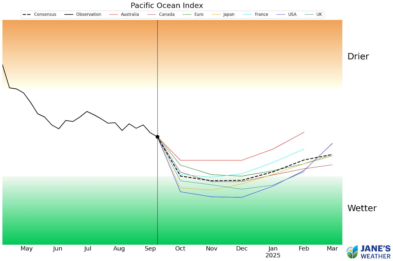
In exciting news to end the week, we now have 7 of the 8 weather models forecasting La Nina as we go into summer. Only one outlier remains, and it isn’t far away from the pack.
The models completed their monthly update overnight, so you are looking at the very freshest guidance here, and the big news is that no longer do we have just 3 or 4 models crossing the threshold, but now it is 7 out of 8.
These 7 are all there by the end of November, and most are there by early October.
The one outlier is the BoM’s (Australia) model. Still sitting on the fence, but it used to be right in the middle of neutral, and now it is a lot closer to the rest of the guidance.
7 out of 8 models now cross the “La Nina” threshold, indicating enhanced tropical moisture from the Pacific Ocean
La Nina encourages moisture to be pushed towards Australia from the Pacific Ocean, enhancing the amount of moisture our weather systems have at their disposal to turn into rain.
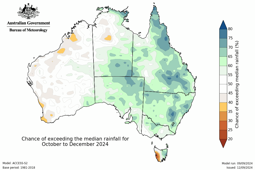
This enhancement is reflected in the seasonal outlook, with much of central and eastern Australia having higher odds for a wetter than average three months.
Rain potential for October to December from the BoM model
Do remember that in order to make it rain you need two things to work together: moisture plus instability.
You can have bucket loads of moisture but without a trigger to convert it from air to cloud, it won’t do much good in producing wet weather.
But it is a great sign that we can place a tick mark next to the moisture part of the equation.
The season ahead will come down to when the low pressure systems (lows, troughs, cold fronts) start tapping into that moisture (shown in big cloudbands on the satellite that link to the tropics) and where will these unstable systems move?
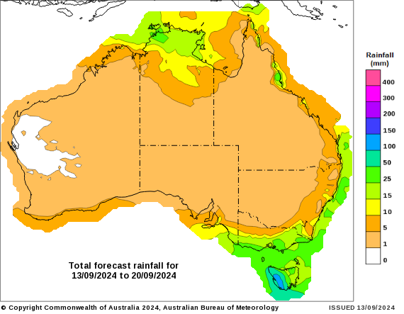
The odds are high for a broad area thanks to the moisture source, but it all depends on where these systems move as to who actually sees the rain… but it is encouraging to see a bit of activity beginning up north in the 8 day rain outlook:
Potential rainfall over the next week (from Friday 13th to Friday 20th September)
Check the full details at Jane’s Weather to keep up to date - with our free 30 day trial, then 10% discount for Auctions Plus members.
If you’d like an in depth analysis don’t miss my weekly video update - perfect if you have 20 minutes to spare!


It is a quiet weather week across the country, with a new large high moving into place, this leading to settled conditions this weekend and next...

Another well timed upper low and trough working through a warm and moist airmass triggered by a positive SAM phase continues to headline the week of...
Great to see a nice full tank of moisture for much of SA and southern WA following a significant week of rainfall with a slow moving low pressure...