
We are inching closer to a Negative Indian Ocean Dipole and seeing how this new phase is set to shake up Australia’s weather with a rain event for all states and territories.
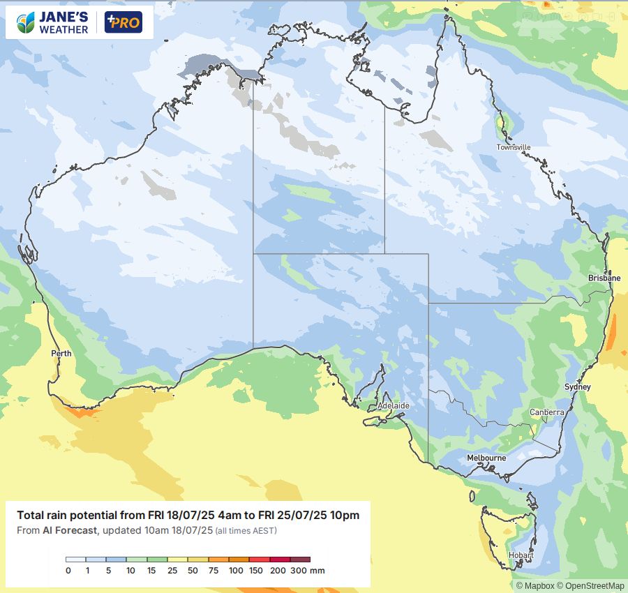
We're about to enter a new weather pattern where moist air from the Indian Ocean surges across Australia, meeting up with low pressure to produce widespread rain for those in its path.
Before this kicks off, we have out of season rainfall for northeast NSW and southeast Queensland. That contracts to the coast for the weekend and early next week.
Meanwhile, the southeast is generally dry, with frosty nights, as high pressure has moved in making the cold fronts slide southwards (producing wet weather in parts exposed to the west but not the rest).
The next big cold front for the southwest is on Sunday. That kicks off a wave of rain that moves across the country early to mid next week.
Another big cold front arrives in the southwest mid next week, kicking off another wave of rain that moves across the country to end the week/next weekend.
Both of these rain events are fed by moisture from the Indian Ocean, and should affect every state and territory on their way through.
As it comes from the northwest there are spots that will miss out. In the southeast this puts Melbourne - Gippsland - southeast NSW, and southeastern Tasmania, on the 'dry' side of the ranges; but WA, SA, northern TAS, northern VIC, western NSW, even southern NT and western Queensland should see some rain.
It's not likely to be huge falls, but instead some nice soaking rain that lasts for a day or two, and then repeats with the next wave a few days later.
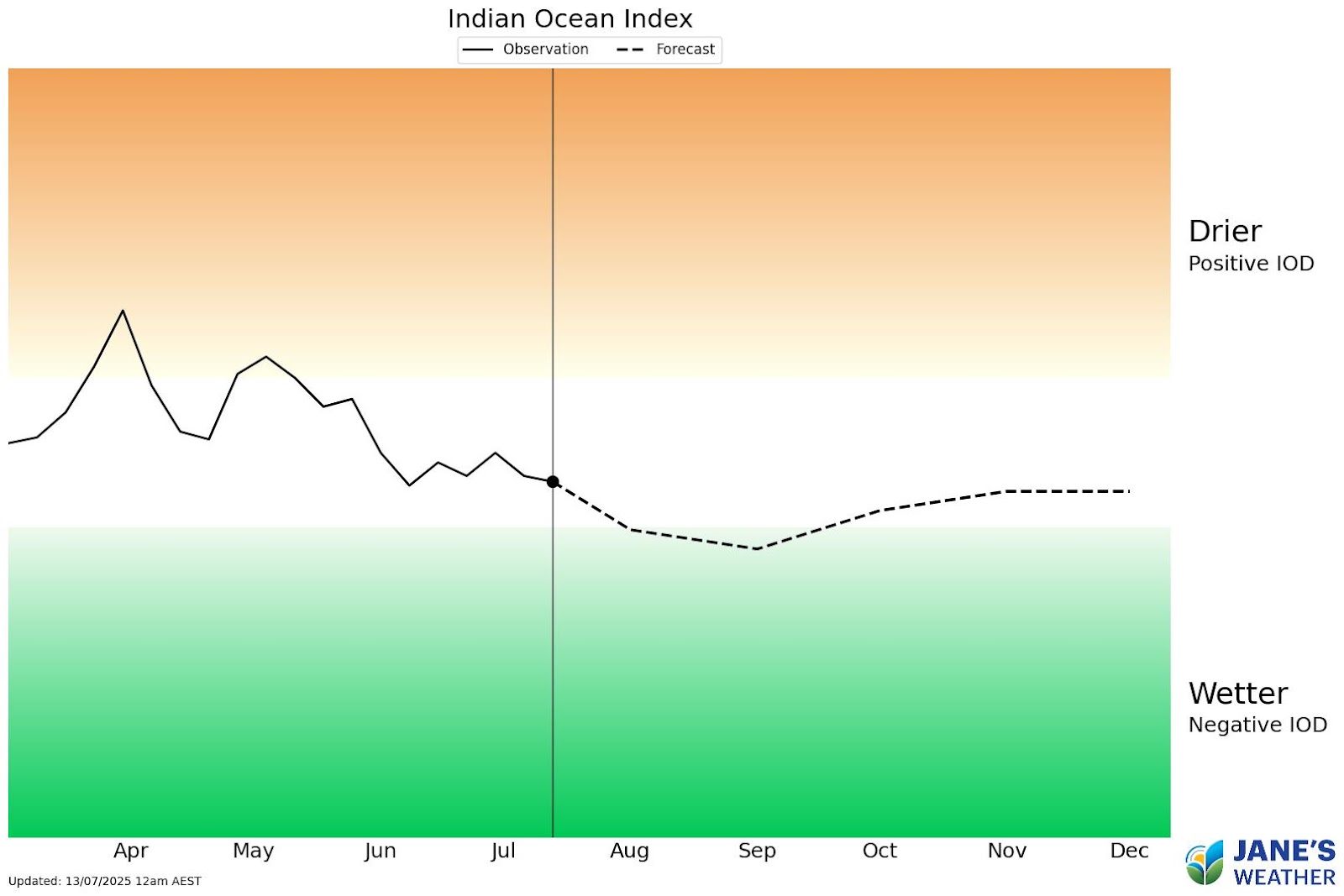
The Indian Ocean continues to transition into our new phase: Negative. This is the ‘La Nina of the Indian Ocean’ without the fancy name. When this index nears and crosses the threshold then moisture is actively pushed towards Australia - and whenever that can meet up with low pressure we see rain.
There is one caveat though - low pressure. In order to make it rain you need both moisture and instability to work together. This new phase means that the moisture part of that equation is locked and loaded, but it’s still up to the troughs, cold fronts and lows to drive that moisture to you and turn it into rain.
For the full update, don't miss this week's video - perfect if you have 12 minutes to spare.

Jane’s Weather provides hyper local weather forecasting based on the consensus of all the weather models, using Machine Learning and AI to calibrate the forecast to conditions at your farm. We include updates on temperature, rain and wind, along with evapotranspiration for efficient water usage, frost risk, growing degree days and a detailed spraying forecast customised for any property in Australia.


