 Jane Bunn - Jane's Weather
Spring preview for some as weather changes
A moderate cold front continues to slowly move through the southwest third of WA with moderate to heavy falls via thunderstorms along the coast and...
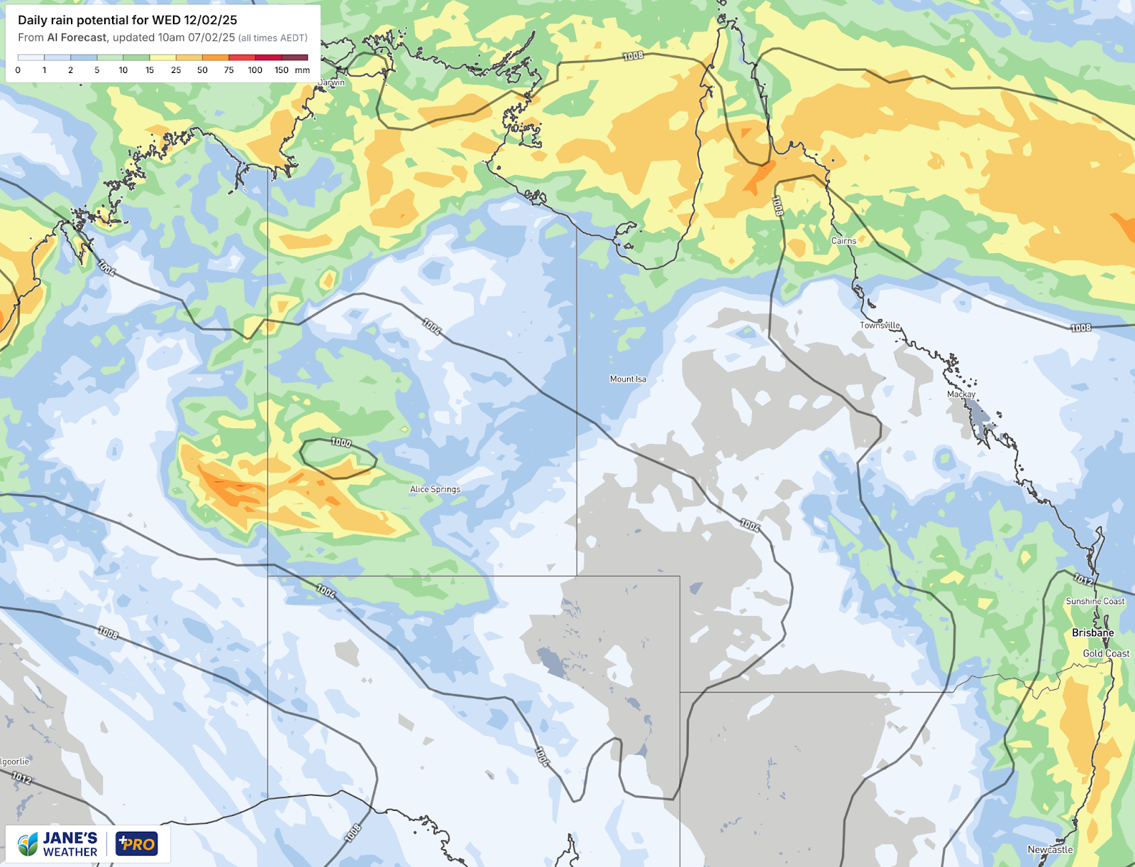
Northern Queenland’s rain finally eases early next week - while parts of the south could pick up some much needed rain instead
The weather pattern finally gets a shake up early next week, with a vast reduction in the amount of rain falling over flooded northern Queensland.
By Wednesday next week Townsville’s daily rain forecast is just 0 to 1 mm.
This is after falls of more than 1600mm - really put into perspective when you consider Brisbane’s monthly average at this time of year is 160mm.
Daily rainfall potential next Wednesday 12th February
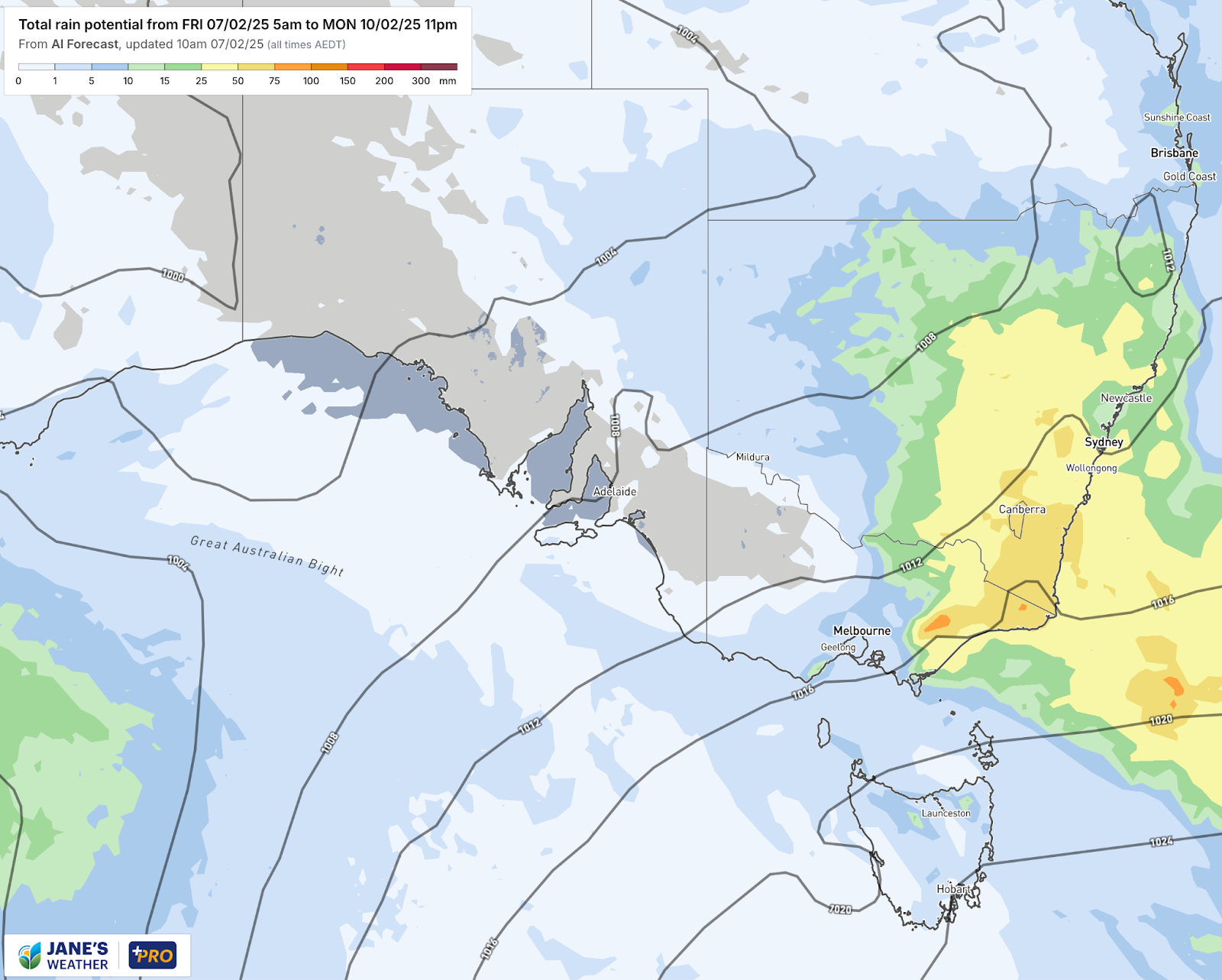
A large part of eastern NSW and far eastern Victoria are in the storm risk zone from today (Friday) through to Monday as an active trough lingers just to the west. These storms have the potential to bring heavy rain to those directly underneath, but as storms are by nature hit and miss, not everyone will see one.
Rainfall potential from Friday to Monday shows increased rain over eastern NSW and far eastern VIC
That still leaves a rather large area to the west through NSW, Victoria and South Australia that has had a lot of heat and hardly any rain. Wilcannia in far western NSW has had exactly 0mm so far this year, and areas like Hay, Griffith and Hillston just 5mm each.
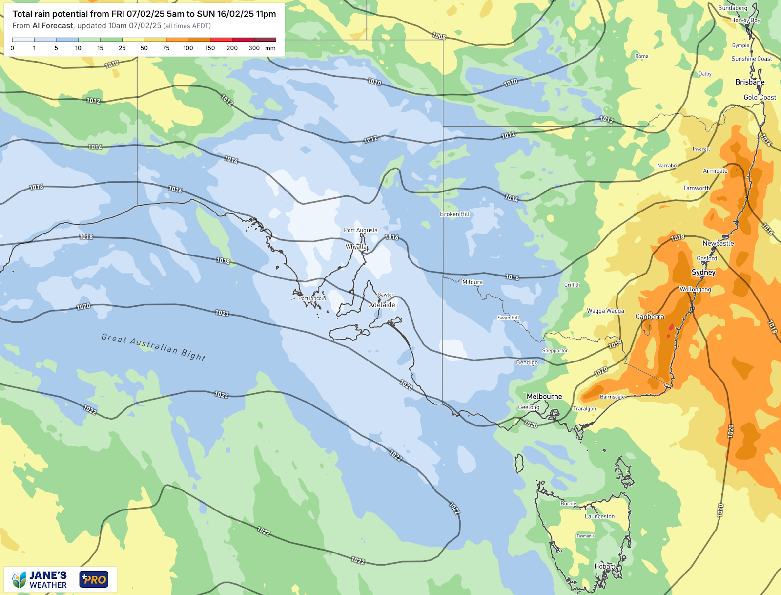
There is the potential for something to sweep through later next week.
It is early days yet (a full week away) so there is low confidence - but this is one to watch if you are needing rain.
The potential for rain increases from late next week through the dry areas of western NSW, western VIC and parts of South Australia
Check the full details at Jane’s Weather to keep up to date on what the models are projecting for your spot. If you’d like an in depth analysis don’t miss my weekly video update - perfect if you have 20 minutes to spare!
Also - Don’t miss my look ahead to the Autumn Break.

Jane’s Weather provides hyper local weather forecasting based on the consensus of all the weather models, using Machine Learning and AI to calibrate the forecast to conditions at your farm. We include updates on temperature, rain and wind, along with evapotranspiration for efficient water usage, frost risk, growing degree days and a detailed spraying forecast customised for any property in Australia.

A moderate cold front continues to slowly move through the southwest third of WA with moderate to heavy falls via thunderstorms along the coast and...

A quiet weather pattern continues for much of the country this week with ridging in place over much of the continent and only the northern tip of...

It is a quiet weather week across the country, with a new large high moving into place, this leading to settled conditions this weekend and next...