 Jane Bunn - Jane's Weather
Spring preview for some as weather changes
A moderate cold front continues to slowly move through the southwest third of WA with moderate to heavy falls via thunderstorms along the coast and...
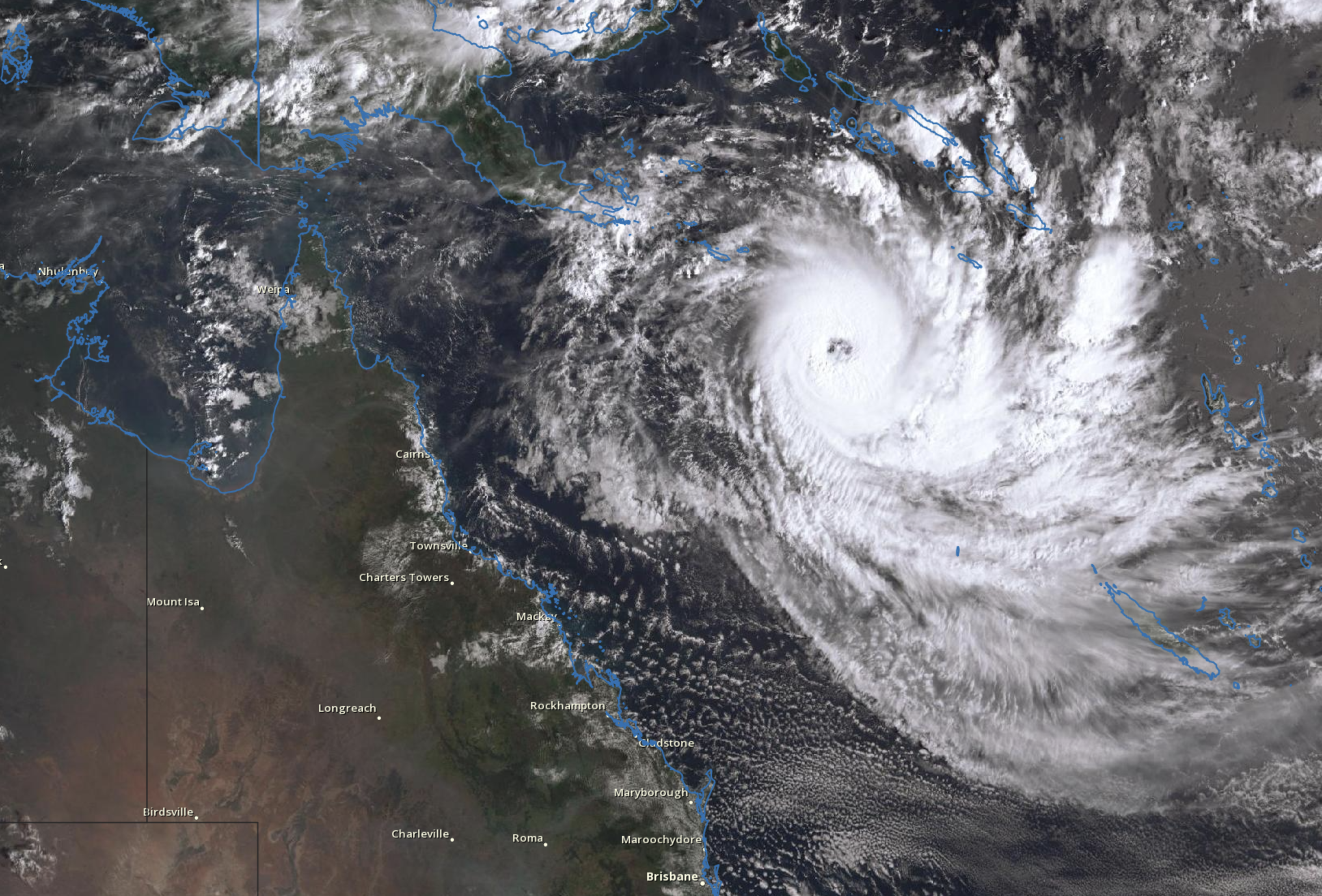
Cyclone Jasper is likely to cross the far northern Queensland coast on Wednesday 13th December 2023.
Keep up to date with the latest guidance on where this cyclone is projected to move, including when it begins to have an impact, and which areas are at risk.
The map shows areas in the Watch Zone, indicating gales to begin within 24 to 48 hours, and areas in the Warning Zone, indicating gales within 24 hours.
The map updates every six hours, increasing to every three hours when communities are under threat.


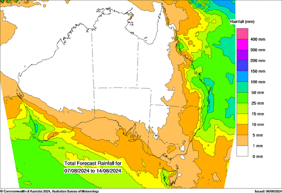
The rain map shows the heaviest falls from Cyclone Jasper are north of Townsville, Queensland. Map updates each morning around 7am (AEST)

A moderate cold front continues to slowly move through the southwest third of WA with moderate to heavy falls via thunderstorms along the coast and...

A quiet weather pattern continues for much of the country this week with ridging in place over much of the continent and only the northern tip of...

It is a quiet weather week across the country, with a new large high moving into place, this leading to settled conditions this weekend and next...