 Jane Bunn - Jane's Weather

Spring preview for some as weather changes
A moderate cold front continues to slowly move through the southwest third of WA with moderate to heavy falls via thunderstorms along the coast and...
.png)
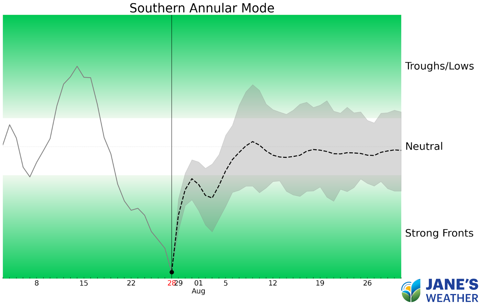
The latest measure of the Southern Annular Mode (SAM) is nearly off the charts negative. SAM controls our weather patterns and a negative burst indicates that we’re seeing strong cold fronts. So where is the rain for southeastern Australia?
The current Southern Annular Mode (SAM) index is extremely negative, indicating strong cold fronts in the weather pattern
The current weather map says it all. High pressure is dominating the southeast of the country, while the strong cold fronts are lining up to affect the west. There is even a trough to the north of the cold fronts, indicating a connection to tropical moisture so the front can deliver even more rain.

The current weather map showing high pressure over the southeast while strong cold fronts approach the southwest
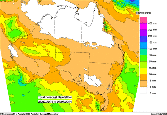
The rain projection for the next week shows that the imbalance is likely to continue. The rain falls in the southwest (more than 50mm near the coast)... a juicy northwest cloudband comes in across central WA (more than 10mm across a large part of the desert)… but it dries up as it heads further east.
There is also wet weather for the east coast, just on the coastal fringe, thanks to the Tasman Sea low.
Projections for rain in the next week (Wednesday 31st July to Wednesday 7th August)
So, that is yet another week where much of the southeast misses out on rainfall thanks to a dominating high pressure system.
Recent changes in the Indian Ocean, with projections showing 4 out of 5 models heading into a negative Indian Ocean Dipole (-ve IOD, the La Nina of the Indian Ocean) should help this situation - but we may not cross the threshold into a negative IOD until September - so there is a little way to go yet.
Keep up to date with both the seasonal outlook, and the details for the next ten days, by checking the full outlook at Jane’s Weather.

A moderate cold front continues to slowly move through the southwest third of WA with moderate to heavy falls via thunderstorms along the coast and...

A quiet weather pattern continues for much of the country this week with ridging in place over much of the continent and only the northern tip of...

It is a quiet weather week across the country, with a new large high moving into place, this leading to settled conditions this weekend and next...