
1 min read

Rain finally fell over the dry southeast, with more on the way

Rain finally fell over the dry southeast, with more on the way

Parts of southwest Victoria and southeast SA finally picked up some decent rain, and the rain bearing weather systems are lining up to deliver more. 

The broad area from Adelaide to Melbourne is usually guaranteed to see rain at this time of year, after the break in autumn and regularly during winter. They’re in a great spot to feel the brunt of cold fronts as they cross the Bight and head over the southeast.   

This year has been very different with high pressure dominating the weather pattern and blocking these weather systems from moving through.

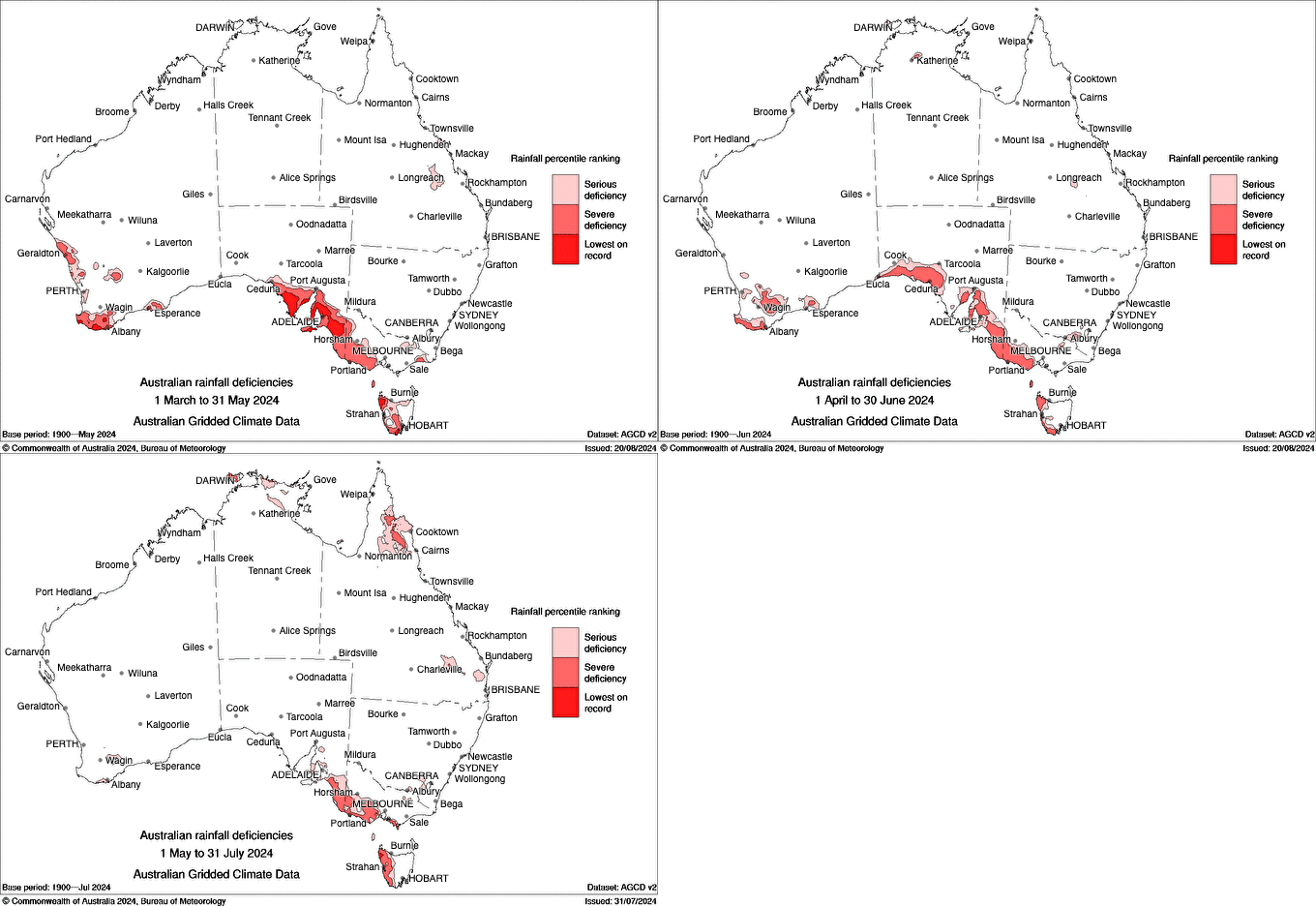
The drought map shows us that a large part of this usually rainy area are affected, and in a comparison from year to year, much of this land is 100 to 200 mm short of where they should be.

Extent of the drought in southeastern Australia in autumn and winter

In lovely news, rainfall was projected to fall late last week - and it actually delivered. 

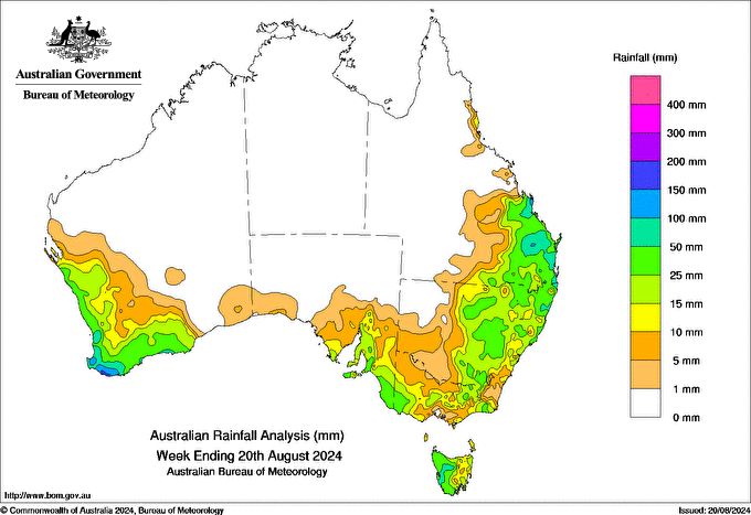
Not just hit and miss activity, but much of the area picking up a handy fall. Thanks to a ‘cut off’ low that wandered through delivering rain to those in its path. 

15 to 40 mm fell across southwestern Victoria and southeastern SA, but if you’re further inland towards the Mallee it was only a few millimetres up to 10mm. The low wasn’t able to impact these areas quite as well. 

Extent of the drought in southeastern Australia in autumn and winter

We’re not done - there is more on the way!

High pressure is still having a detrimental impact - but less so than it has in the past. Instead we’ll have a conveyor belt of cold fronts line up to impact southeastern Australia one after another, after another. 

They don’t have a tropical connection, and the high won’t let them push through as far as they could - so if you’re north of the ranges the rainfall totals taper off pretty fast. 

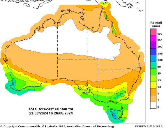
But if you’re in that key drought area between Adelaide and Melbourne, there is another 15 to 40 mm on the way over the next week. 

Projections for rain in the next week (Wednesday 21st to Wednesday 28th August)

See when and how much rain is likely at your spot, by checking the full outlook at Jane’s Weather. 

Settled conditions this week, drier outlook continues to build

Settled conditions this week, drier outlook continues to build

It is a quiet weather week across the country, with a new large high moving into place, this leading to settled conditions this weekend and next...

Read More >
Multiple rain rounds for the southeast, but a drier turn is coming

Multiple rain rounds for the southeast, but a drier turn is coming

Another well timed upper low and trough working through a warm and moist airmass triggered by a positive SAM phase continues to headline the week of...

Read More >
Ridge rebuilds after a big rain week, with El Niño declared

Ridge rebuilds after a big rain week, with El Niño declared

Great to see a nice full tank of moisture for much of SA and southern WA following a significant week of rainfall with a slow moving low pressure...

Read More >