 Jane Bunn - Jane's Weather
We're likely at peak soil moisture across continent
The weather pattern is generally stable and with more high pressure on the horizon, this is indicative of the El Niño that is starting to influence...
.png)
The lengthy cold spell really has settled in for the long haul. In the eastern states both maximum and minimum temperatures are generally running several degrees below the long term average for this time of year. You know it’s chilly when it stretches right up into Queensland with frosty mornings on the Darling Downs - but how much longer will it last?
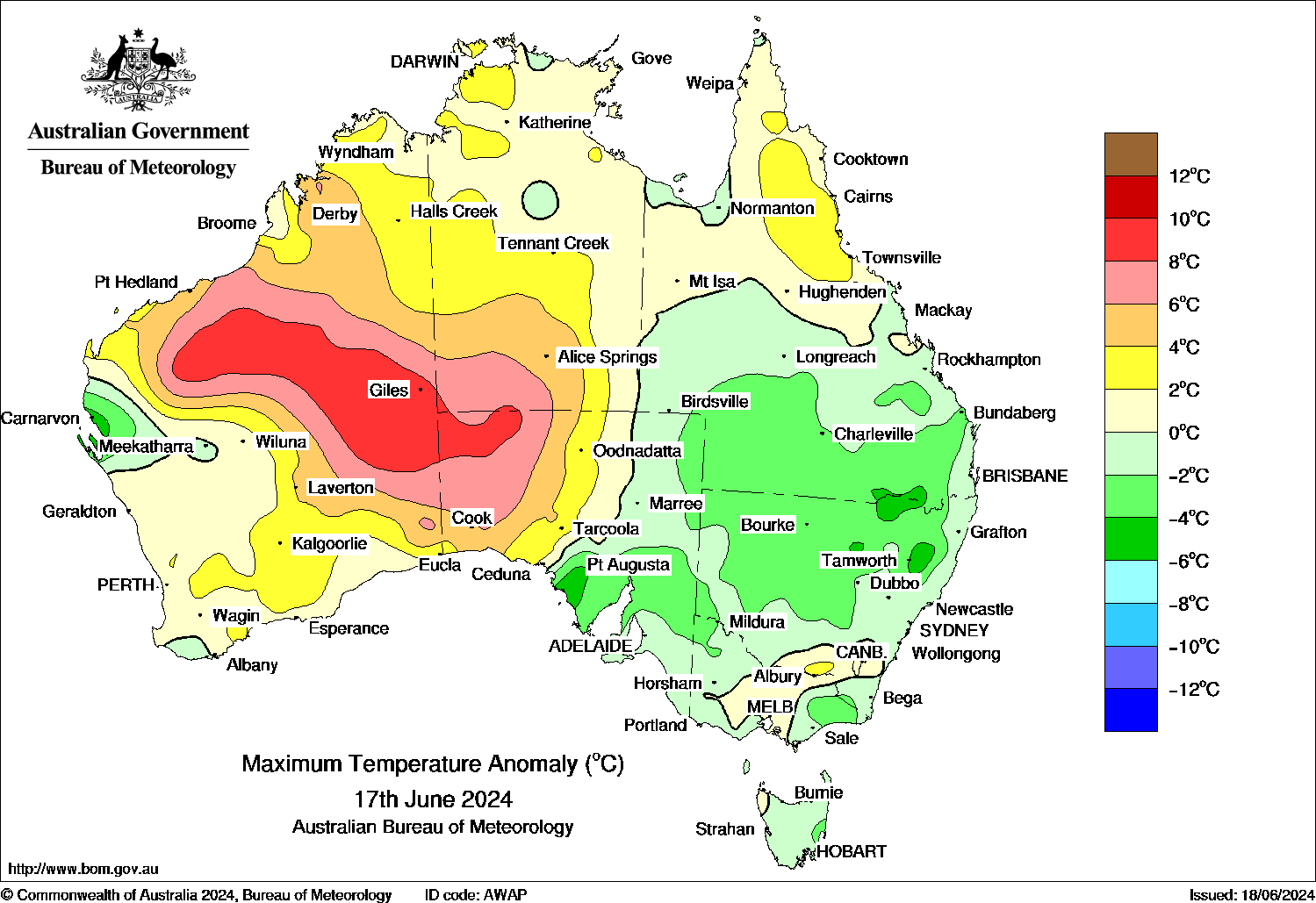
The colours on the map show just how many degrees below average it is - and if you’re in a spot showing light blue, that’s 6 to 8 degrees below.
How much warmer or cooler than average each day has been across Australia
The effects of this cold spell are compounded by the fact that it isn’t just a cold snap, not just a day or two, but lingering over an extended period of time. Stubborn high pressure has placed itself perfectly to ensure a cold pool of air remains stuck over the eastern states. And we still have at least half a week or longer until the weather pattern shakes up.
It’s also important to note that the cold air is balanced out. It’s not cold everywhere.
The map above also shows large areas of warmer than average air, generally in the west, with some areas reaching 8 to even 10 degrees above average. Alice Springs was just shy of 28C yesterday afternoon - the June average is 20C. If you’re shivering in the southeast, either of those temperatures would sound lovely.
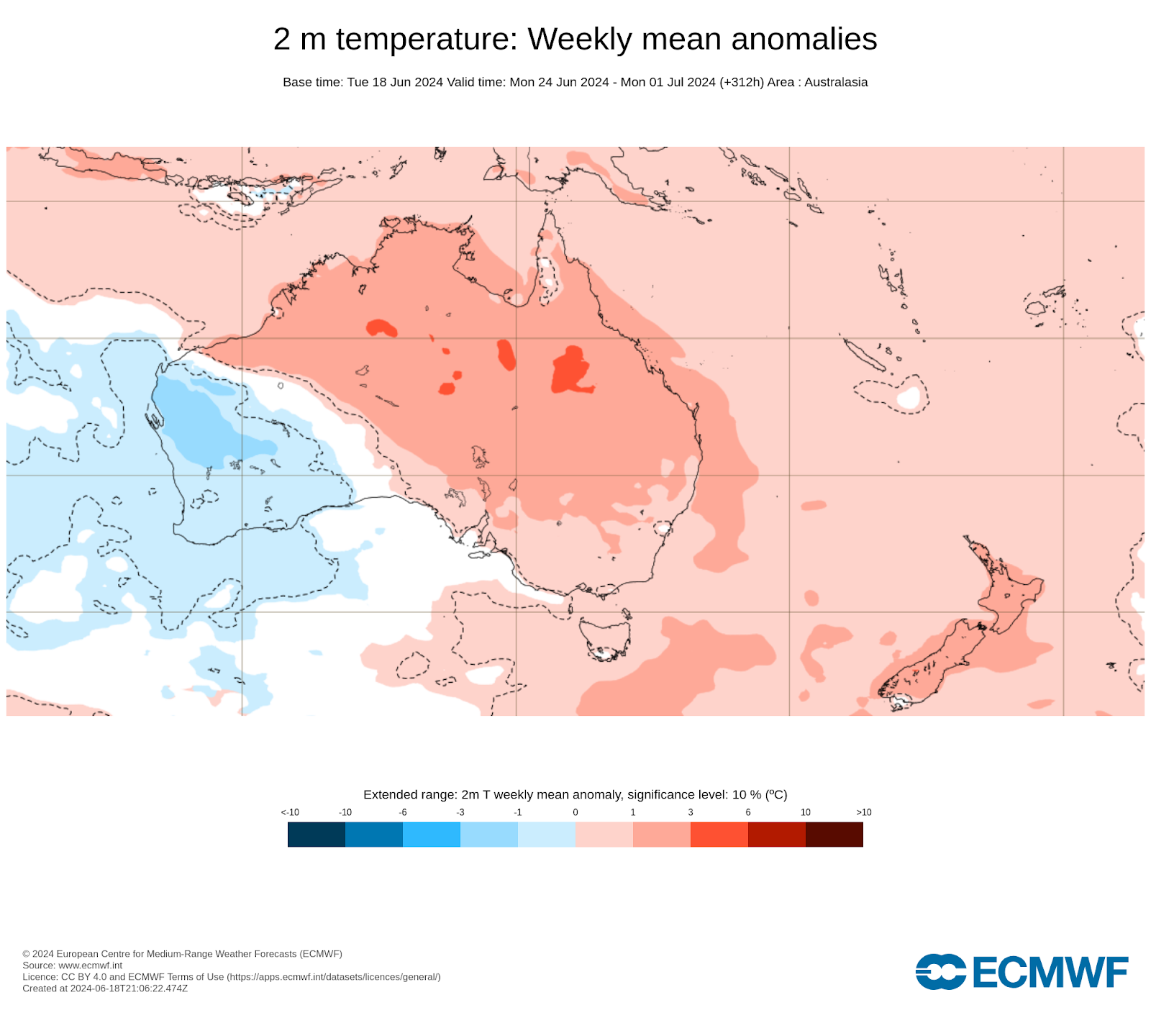
Once the pattern shifts, some of this warmer than average air should push into the eastern states. Next week is looking positively balmy in comparison, overall:
Next week’s projections from the Euro model for how much above or below average the temperature is likely to be overall
Now, it is only a degree or two above, but that’s a step up from our current situation. It won’t be warmer than average all the time, as weather systems are moving through, but just above average overall.
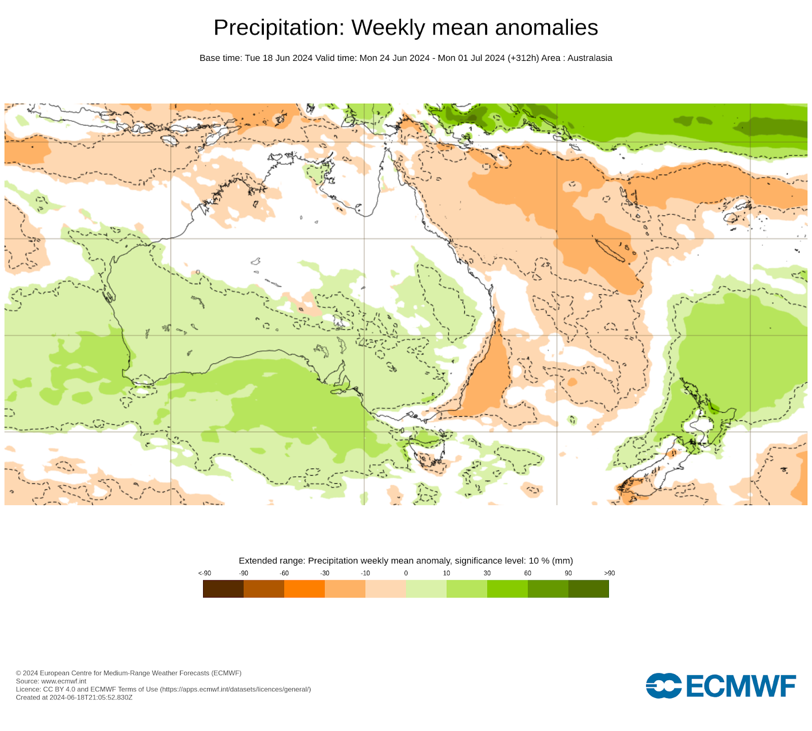
Switching to rain, and next week looks set for weather systems to peak in the southwest (also shown by the colder than average projections for the southwest in the image above). They should then roll across to the east, drying up as the rain heads over the Great Dividing Range. That means inland parts see the rain, rather than the east coast.

However, there are signs of that cold pool in the west ensuring that a feed of moisture runs into low pressure in the east. This is one to watch as it could create some out of season rain in parts of QLD and eastern NSW later next week. We’ll see if that is on track to be the focus of my update next Wednesday!
Next week’s projections from the Euro model for how much above or below average the temperature is likely to be overall
Keep up to date with the cold and the rain specifically at your spot, by checking the full outlook at Jane’s Weather.

The weather pattern is generally stable and with more high pressure on the horizon, this is indicative of the El Niño that is starting to influence...

A moderate cold front continues to slowly move through the southwest third of WA with moderate to heavy falls via thunderstorms along the coast and...

A quiet weather pattern continues for much of the country this week with ridging in place over much of the continent and only the northern tip of...