 Jane Bunn - Jane's Weather
We're likely at peak soil moisture across continent
The weather pattern is generally stable and with more high pressure on the horizon, this is indicative of the El Niño that is starting to influence...
.png)
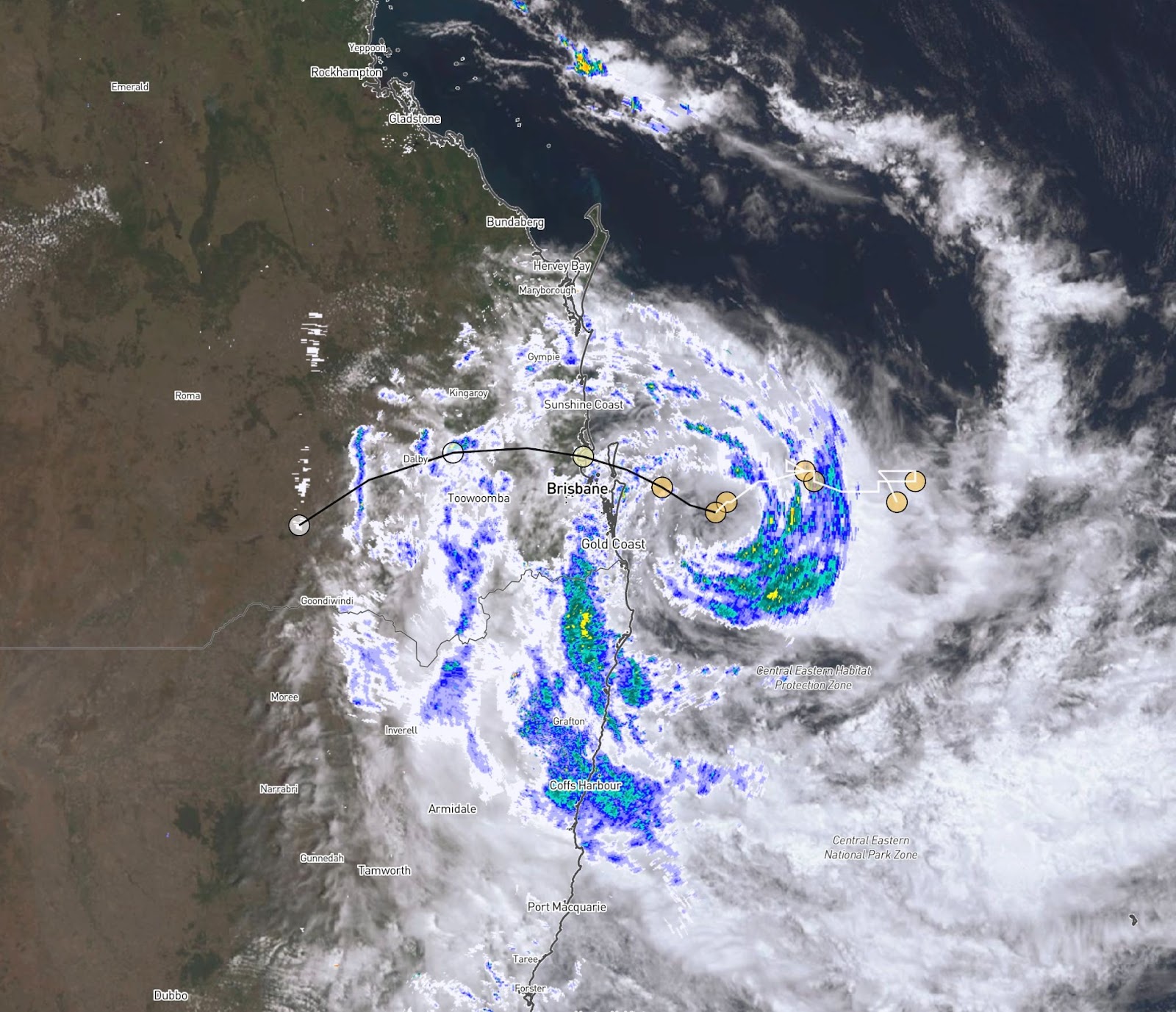
Cyclone Alfred brings concerns of winds, rain and water to a large part of the southeast Queensland and northeast NSW coast. With a crossing around Brisbane on Saturday morning, that’s not the only danger point.
The path so far has included lots of veering, slowing down, speeding up and even loop-de-loops, and it is important to remember that the official forecast path is a smooth version of where it may go.
This wobbly pattern means that once it nears the coast, it's not just one location that experiences the dangerous conditions, but a large area. These effects are most felt from Friday afternoon right through to after Alfred finally crosses and moves just inland on Saturday afternoon. Then the rain and winds only slowly moderate after that.
The concerns with Alfred:
WINDS
Damaging Wind Gusts up to 120km/h for a large part of the coast
Destructive Wind Gusts up to 155km/h near and to the south of the core
RAIN
Heavy rainfall, 400 - 800 mm over the course of the event
Locally intense rainfall which may lead to Dangerous and Life-Threatening Flash Flooding near and to the south of the core
WATER
Damaging Surf and Significant Beach Erosion
A Dangerous Storm Tide if the crossing coincides with High Tide, and Abnormally High Tides
Minor to Major Flooding in the days and weeks ahead
Satellite, Radar and Potential (smooth) Track Map as of early Friday afternoon
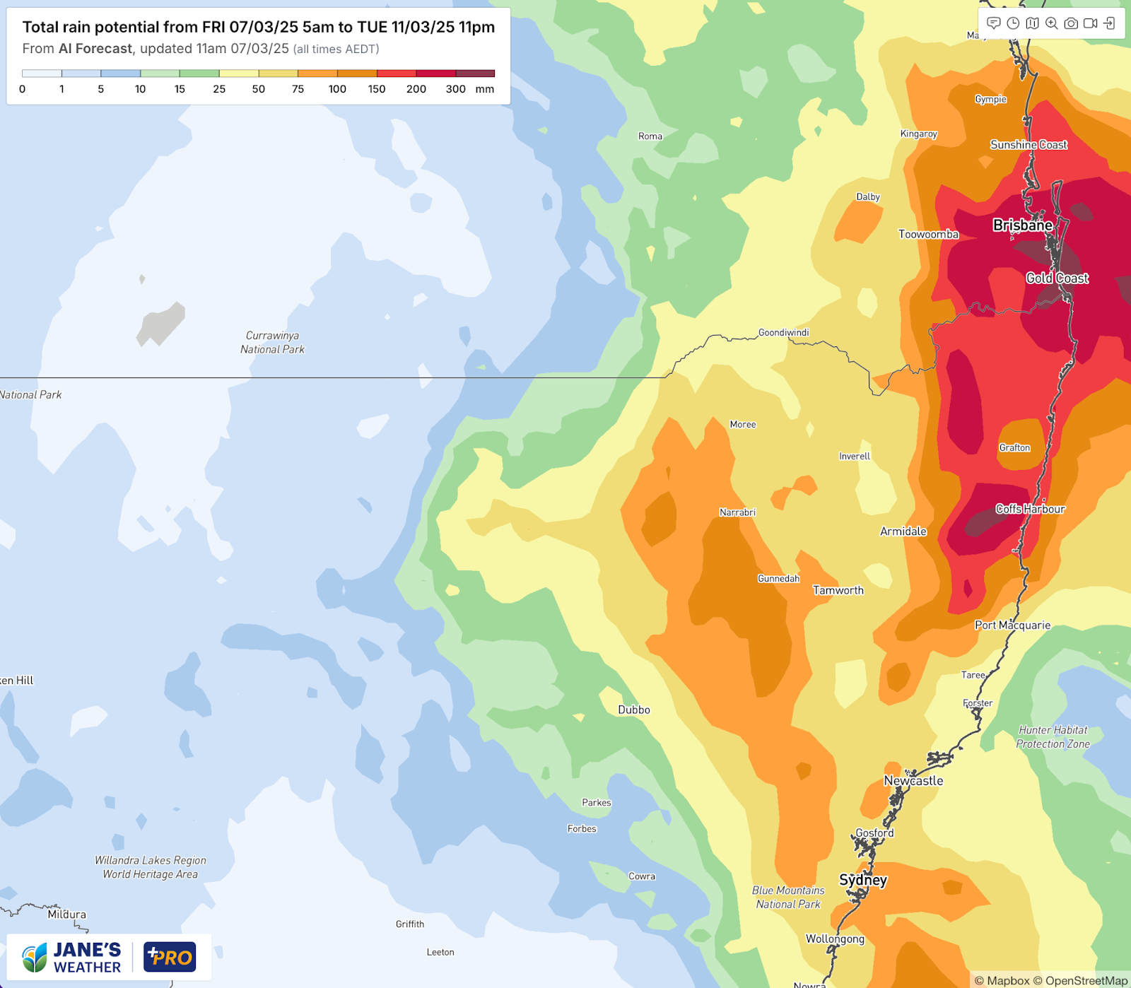
Once Alfred crosses the coast there will be several days of rainfall near the path of the ex-cyclone. Significant rainfall should extend inland to the NSW central north and southwards as far as Wollongong - over the weekend and early next week.
By the end of Tuesday there is significant rain through all these areas (anything yellow is at least 25mm, orange is 75-150mm, then deeper reds for the huge totals):
Potential rainfall totals from Cyclone Alfred, through to later on Tuesday
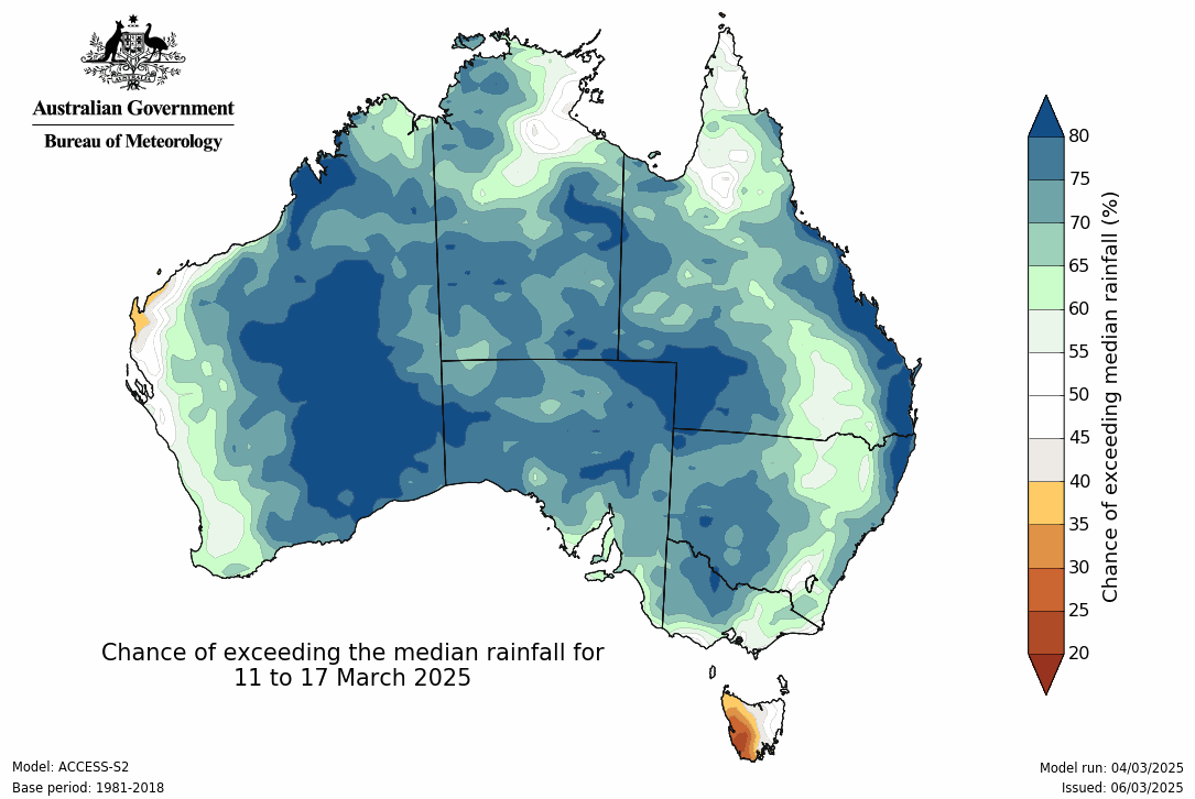
Southern Australia misses out on this one, but there may be a weather system brewing on the horizon. BoM’s seasonal model currently loves the idea of widespread rain, but do know that as it is a full week away, confidence is very low at this stage:
Potential rainfall totals from Cyclone Alfred, through to later on Tuesday
There is a lot of heat to get through before that potentially arrives - and for an in depth look at all of this, plus the latest on the season ahead, don’t miss my latest video analysis: https://youtu.be/KPQ2eaitGkg

Jane’s Weather provides hyper local weather forecasting based on the consensus of all the weather models, using Machine Learning and AI to calibrate the forecast to conditions at your farm. We include updates on temperature, rain and wind, along with evapotranspiration for efficient water usage, frost risk, growing degree days and a detailed spraying forecast customised for any property in Australia.

The weather pattern is generally stable and with more high pressure on the horizon, this is indicative of the El Niño that is starting to influence...

A moderate cold front continues to slowly move through the southwest third of WA with moderate to heavy falls via thunderstorms along the coast and...

A quiet weather pattern continues for much of the country this week with ridging in place over much of the continent and only the northern tip of...