
1 min read

South may see rain relief next weekend as the stubborn dry pattern shows early signs of shifting

South may see rain relief next weekend as the stubborn dry pattern shows early signs of shifting
Pic: AgriShots
South may see rain relief next weekend as the stubborn dry pattern shows early signs of shifting
2:22

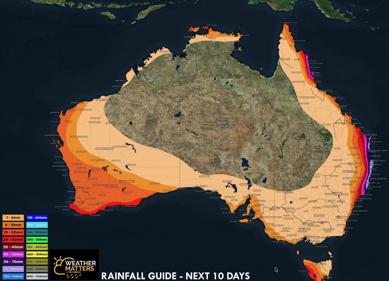
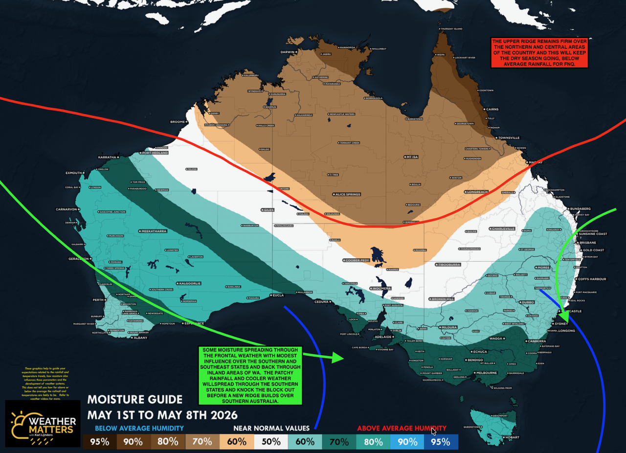
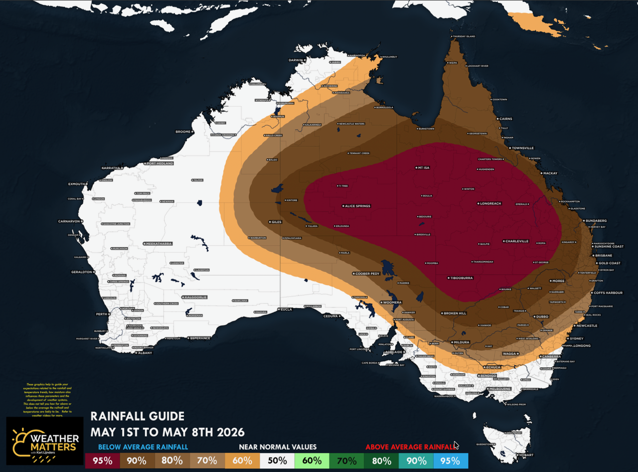
It feels like Ground Hog day across the continent at the moment as a blocking pattern remains fixed over the southeast parts of the nation, blocking up the westerly wind belt and trapping dry air leading to rinse and repeat weather through the weekend and most of next week nationally. The winners related to rainfall under this pattern is southwest WA, where frontal weather will be passing through and trying to tap into moisture surging through the Indian Ocean, leading to periodic patchy rainfall emerging over the next week. Some areas could see up to 10mm but the rainfall uneven in distribution over inland areas of WA. Falls about coastal areas south from Perth may reach 20mm.

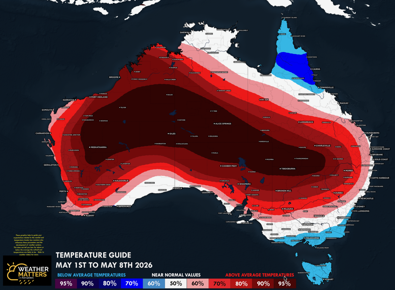
The losers related to rainfall, the rest of the continent. The ridging and drier air leading to stable weather. Cool nights, mild to warm and mainly sunny days. Cloud coverage passing through the nation from WA becomes inactive under the ridging and drier airmass. This takes us through to this time next week.

However, models are playing with the idea of a stronger long wave approaching from next week near WA, that surges into the Bight. While this system slows down near SA, it could knock the blocking pattern toward NZ, and this may open the door for rainfall developing for southern and southeast Australia from next weekend, and a drop in temperatures.

But other than that, it is looking lean on rainfall with above average temperatures.

This is the short walk into the drought that is expected to emerge in Winter and more on that to come in the weeks ahead.

In other climate news, there is an increased risk of a positive IOD developing, hand in hand with a the strong El Niño signal through the back of this year. That may see a compounding of the drought development and the intensity of a drought developing this year.

I will see you next week.


Karl Lijnders is the founder of Weather Matters, which provides short, medium and longer-range weather forecasts, updated daily, with a focus on Australian ag and what the weather and climate means to you.

Subscribe to a Yearly Plan and use the discount code at checkout - APLUS - to save $200 on a Yearly Plan!

Frosts intensify and spring heat looms as El Nino signals build

Frosts intensify and spring heat looms as El Nino signals build

Another quiet week of weather is on the way. The coverage and strength of the frontal weather is expected to be more of a feature for those exposed...

Read More >
We're likely at peak soil moisture across continent

We're likely at peak soil moisture across continent

The weather pattern is generally stable and with more high pressure on the horizon, this is indicative of the El Niño that is starting to influence...

Read More >
Spring preview for some as weather changes

Spring preview for some as weather changes

A moderate cold front continues to slowly move through the southwest third of WA with moderate to heavy falls via thunderstorms along the coast and...

Read More >