 Karl Lijnders
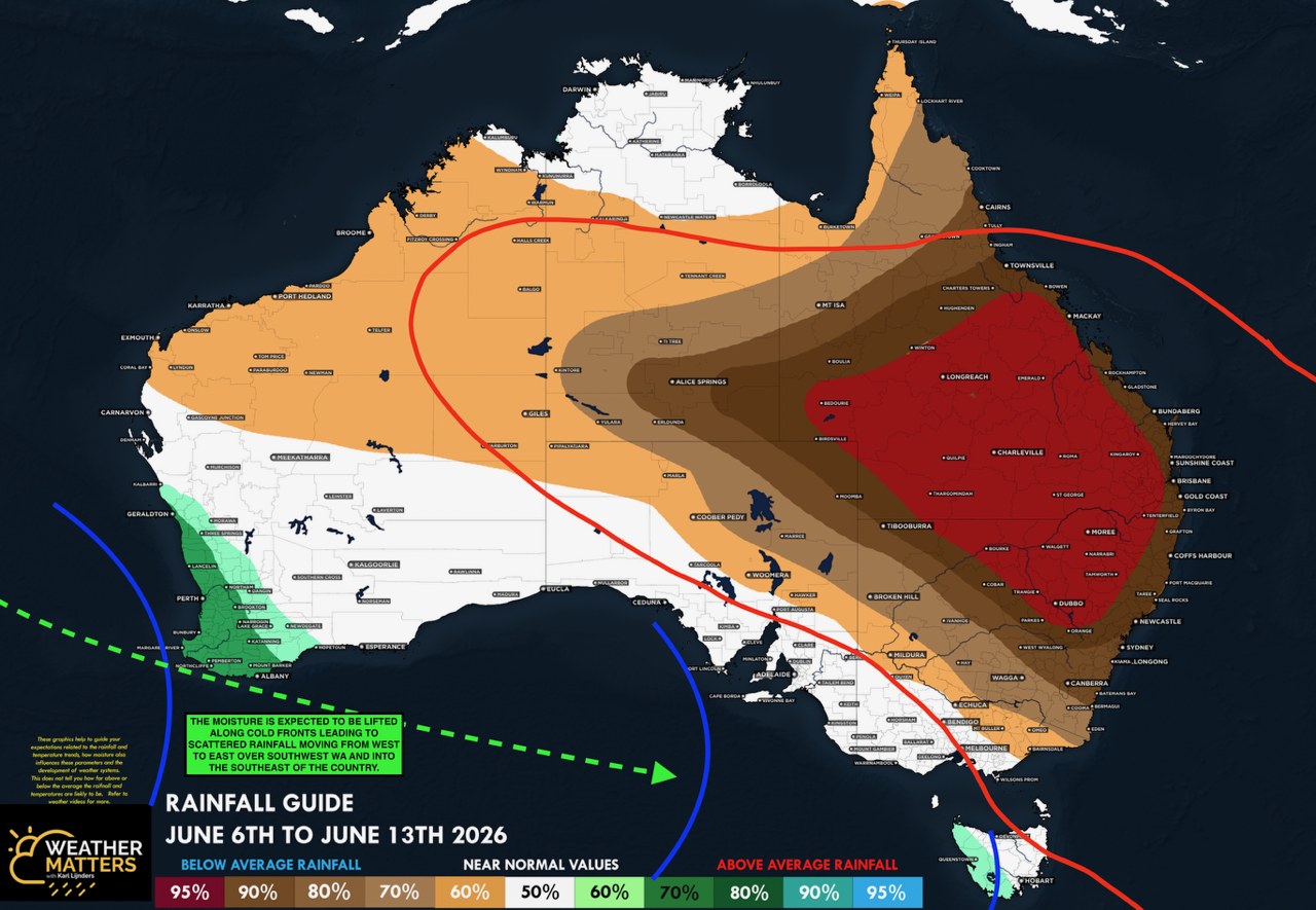
We're likely at peak soil moisture across continent
The weather pattern is generally stable and with more high pressure on the horizon, this is indicative of the El Niño that is starting to influence...
After a decent rain event over multiple states during the past week, the weather pattern shifts and a large scale front and low is expected to feature. Leading into El Niño years, we do get rain events, and even during El Niño events, it can rain, but the rainfall frequency and intensity scales downward month on month. We are yet to feel the impacts of El Niño, it is still forming. So make the most of the moisture that has fallen.
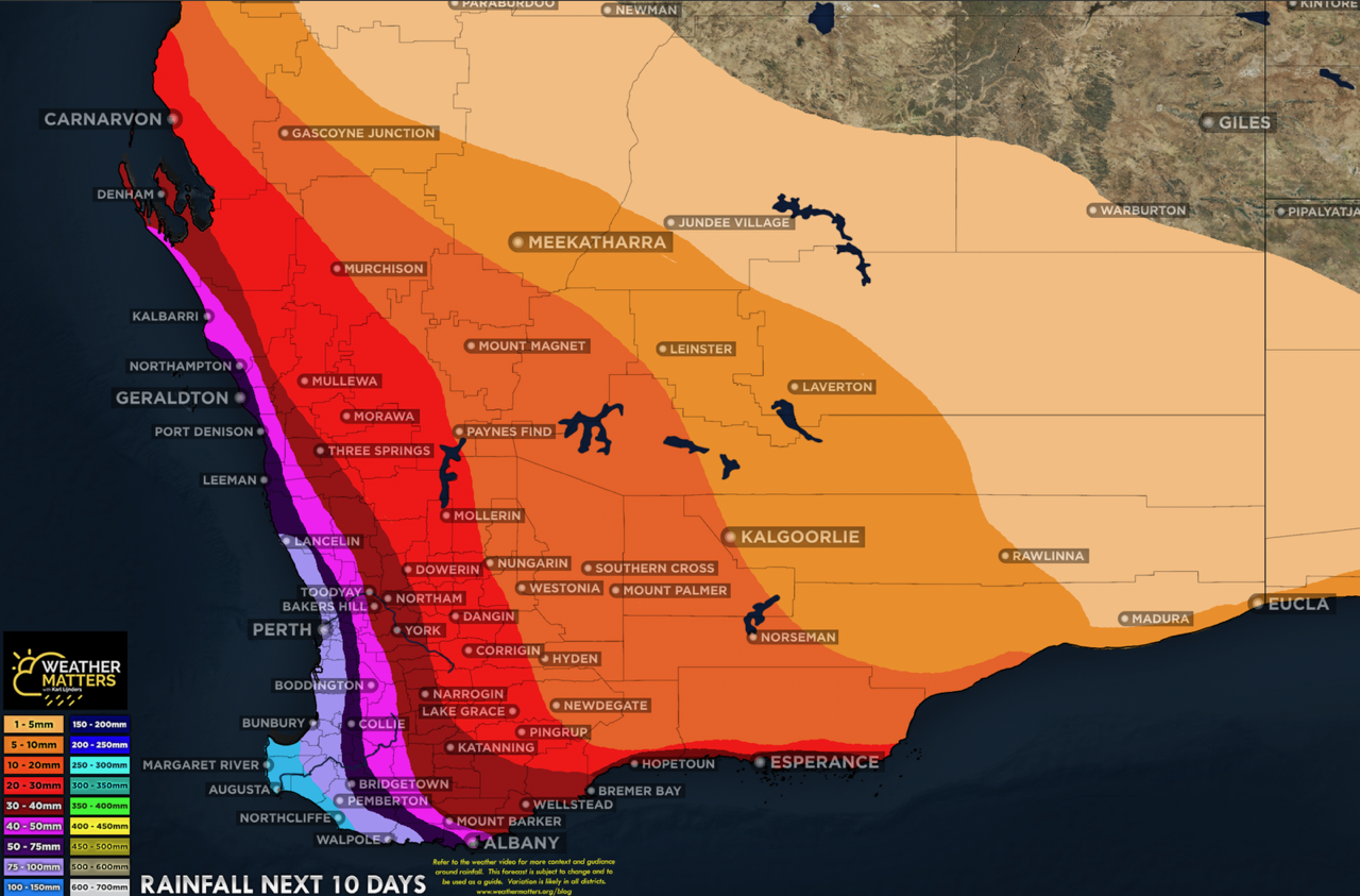
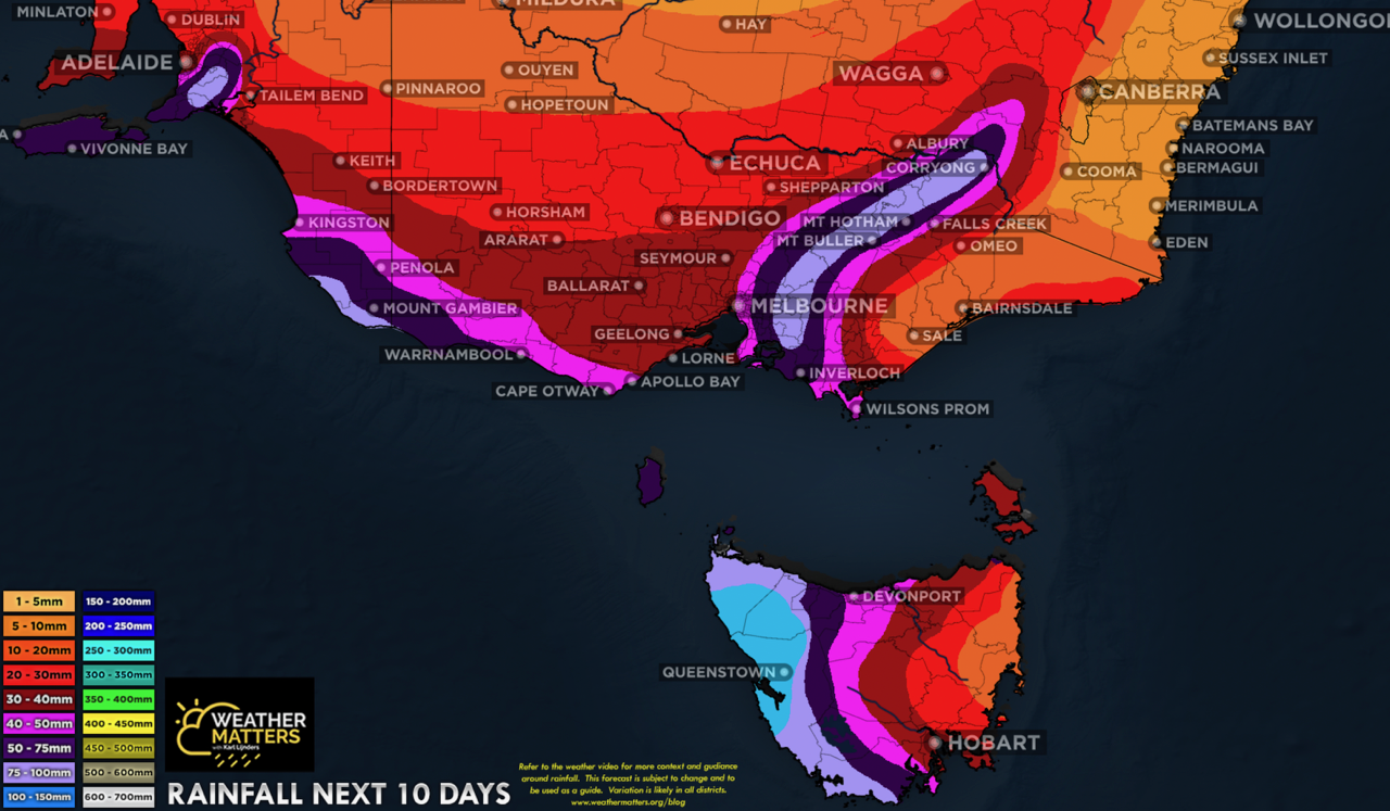
Back to the weekend and week ahead, and the pattern shifts with a significant spell of westerly winds to develop across the southern states and the strongest low pressure system and front of the year thus far, impacting WA this weekend, spreading east through next week.
Frontal weather continues to work into southwest WA. The frontal intensity looks to be peaking around the weekend and Monday with the most widespread rainfall expected during this time across southern WA. That is forecast to move through to the east during early next week. The strongest front of the year is due in SW WA on Sunday and a major storm will run through southern Australia next week.
The frontal weather brings further showery weather next week over the southern states but the remainder of the nation looks dry and stable. Though a band of patchier rainfall may spread through the Food Bowl and southeast inland of the nation on Monday to Tuesday along a trough, but this is short lived.
The first week of June displaying a more traditional period of weather, with the upper ridging across the northern tropics extending to the eastern parts of QLD leading to a drier weather picture in these zones, with near seasonal temperatures. The most active weather runs under the ridging across the mainland with waves of low pressure passing through.
There may be drier weather developing further south across NSW and into VIC during the second week of June with signals of a high pressure ridge developing over the region and that ridge blocking up the weather pattern again.
I will see you next week
Karl Lijnders is the founder of Weather Matters, which provides short, medium and longer-range weather forecasts, updated daily, with a focus on Australian ag and what the weather and climate means to you.
Subscribe to a Yearly Plan and use the discount code at checkout - APLUS - to save $200 on a Yearly Plan!

The weather pattern is generally stable and with more high pressure on the horizon, this is indicative of the El Niño that is starting to influence...

A moderate cold front continues to slowly move through the southwest third of WA with moderate to heavy falls via thunderstorms along the coast and...

A quiet weather pattern continues for much of the country this week with ridging in place over much of the continent and only the northern tip of...