 Jane Bunn - Jane's Weather
Spring preview for some as weather changes
A moderate cold front continues to slowly move through the southwest third of WA with moderate to heavy falls via thunderstorms along the coast and...

We have a long lasting, significant weather system brewing for next week.
In the next week there is the potential for more than 25mm - an inch of rain - across the majority of southeastern Australia. Across southeastern SA, all of VIC and TAS, and southern NSW - the significant falls extend so far inland they reach Broken Hill.
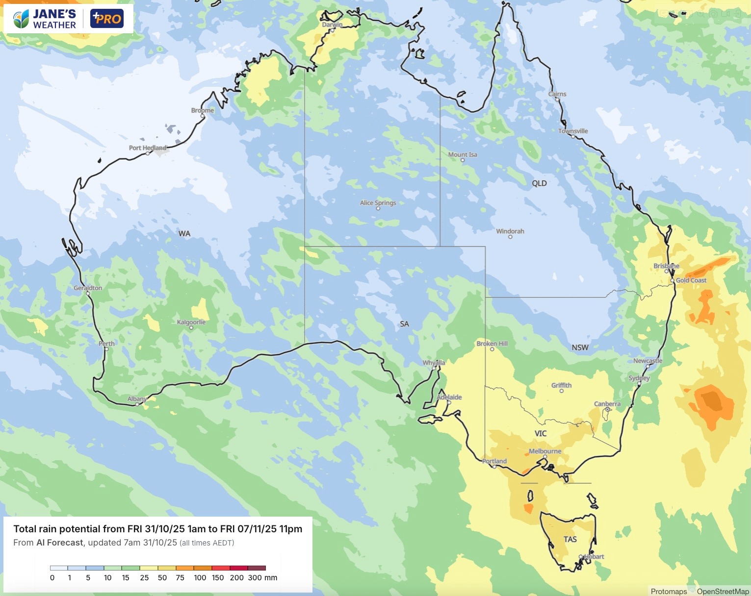
Potential rain over the next week - anything yellow is at least 25mm/an inch of rain
As we go through Friday and Saturday there is a weak trough slowly crossing the eastern states. This brings areas of light and patchy rain, but also hit and miss showers and thunderstorms. If you're directly under a storm it will bring a heavy fall - otherwise as we go into the weekend it doesn't add up to much.
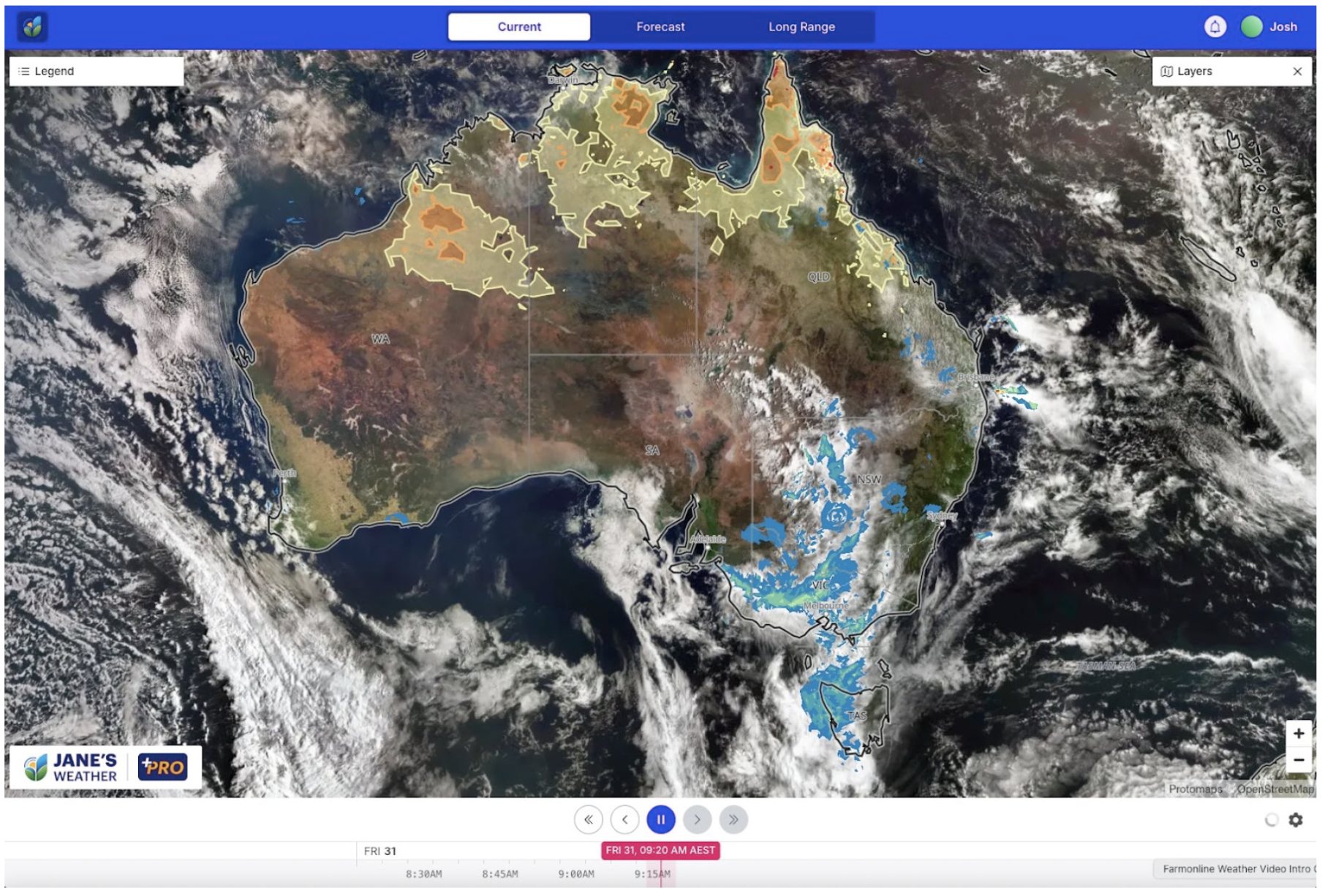
Satellite, radar and current heatwave areas on Friday morning
It is the following system that is the big one. Keep an eye on the day by day rain maps to see where it is heading, but it is likely to take from Sunday through to next Wednesday to cross central parts and the east.
And that is sure to create a bit of havoc at Flemington...
This is our classic combination of tropical moisture pouring into low pressure - working together in a spectacular way. With a Negative Indian Ocean Dipole, weak/near La Nina, and considerably warmer than average waters around the majority of Australia - we certainly have the moisture part of the rainfall equation.
READ MORE: BOM backflips on radar changes
The low pressure part of the equation is a slow moving low with a trough extending into the north. The trough spreads a band of rain through, while the low slowly wanders (as it is cut off from the fast moving westerly winds to our south), with rain circling around its centre. Latest guidance on Friday morning has most models suggesting a path that slowly tracks southwards, across southern NSW, VIC then TAS.
Then there may be another big system to follow, beginning in the west next Tuesday/Wednesday.
After that, we have weather modelling that isn't in agreement for the following week - beginning Monday November 11th.
The Euro model likes large areas of average to below average rain:
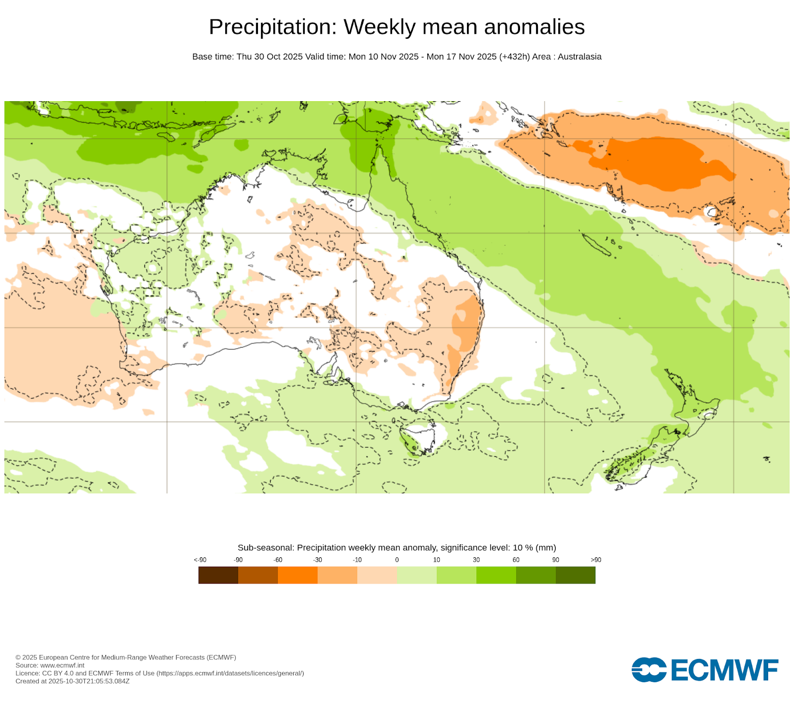
Potential for above or below average rain in the week beginning Monday 10th November - from ECMWF model
BoM's model has quite a different outlook, with above average rain for much of the south and east, and interior:
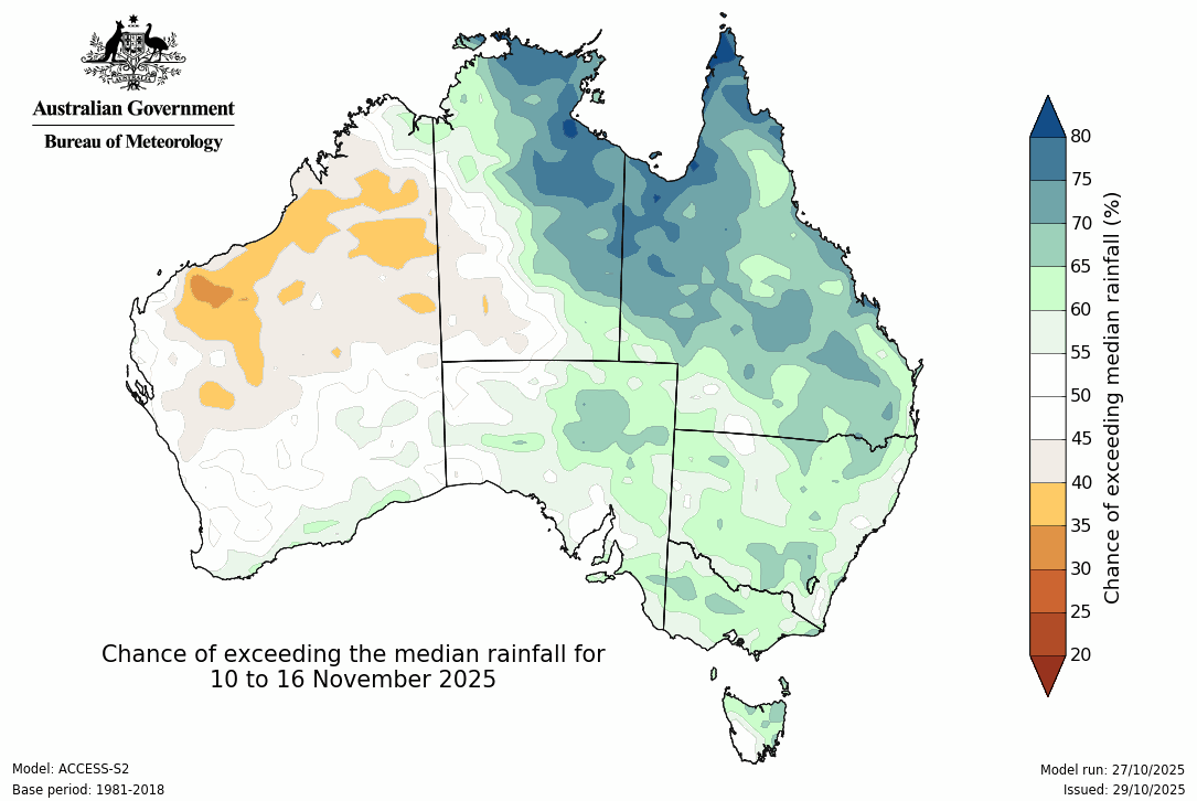
Potential for above or below average rainfall in the week beginning Monday 10th November - from BoM ACCESS model
Don't miss my latest video as I walk you through all these maps, as well as the latest on La Nina and Negative IOD - perfect if you have 14 minutes to spare!

Jane’s Weather provides hyper local weather forecasting based on the consensus of all the weather models, using Machine Learning and AI to calibrate the forecast to conditions at your farm. We include updates on temperature, rain and wind, along with evapotranspiration for efficient water usage, frost risk, growing degree days and a detailed spraying forecast customised for any property in Australia.

A moderate cold front continues to slowly move through the southwest third of WA with moderate to heavy falls via thunderstorms along the coast and...

A quiet weather pattern continues for much of the country this week with ridging in place over much of the continent and only the northern tip of...

It is a quiet weather week across the country, with a new large high moving into place, this leading to settled conditions this weekend and next...