 Jane Bunn - Jane's Weather
Spring preview for some as weather changes
A moderate cold front continues to slowly move through the southwest third of WA with moderate to heavy falls via thunderstorms along the coast and...
Once the rain clears the southeast today, a period of settled weather follows. Meanwhile, the monsoon has arrived in the north, and will continue to encourage a lot of wet weather there. One of the monsoon lows is off the Queensland coast and has the potential to develop into a cyclone and head for the coast later next week.
Once the rain clears the southeast today, a period of settled weather follows. Not just one or two days, but about five in a row. No troughs, no instability - a run of mild, then warm to hot days, that are generally sunny.
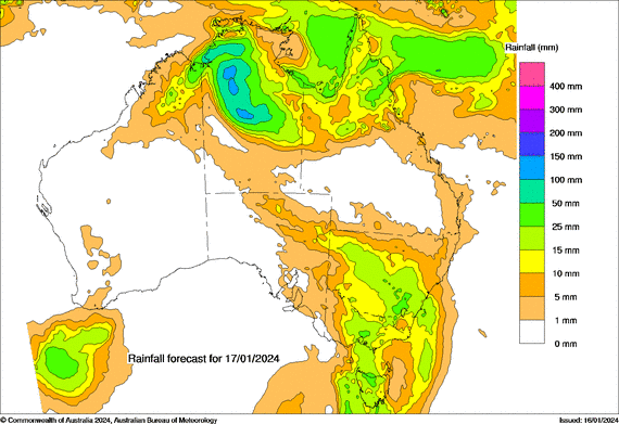
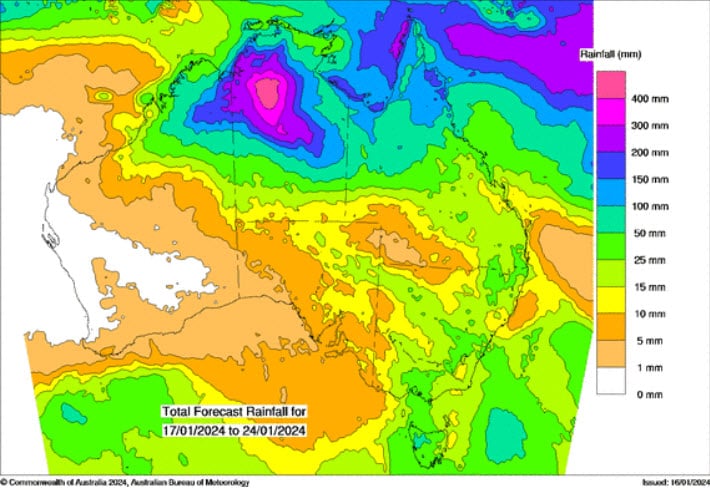
Potential rain each day from Wednesday, January 17 to Sunday January 21.
However, we are in El Nino, and a run of stable weather with a northerly wind leads to extreme heat. The heat may become extreme inland as the days roll by.
This dry period should continue until around Tuesday or Wednesday next week, when the next instability and cool change arrives.
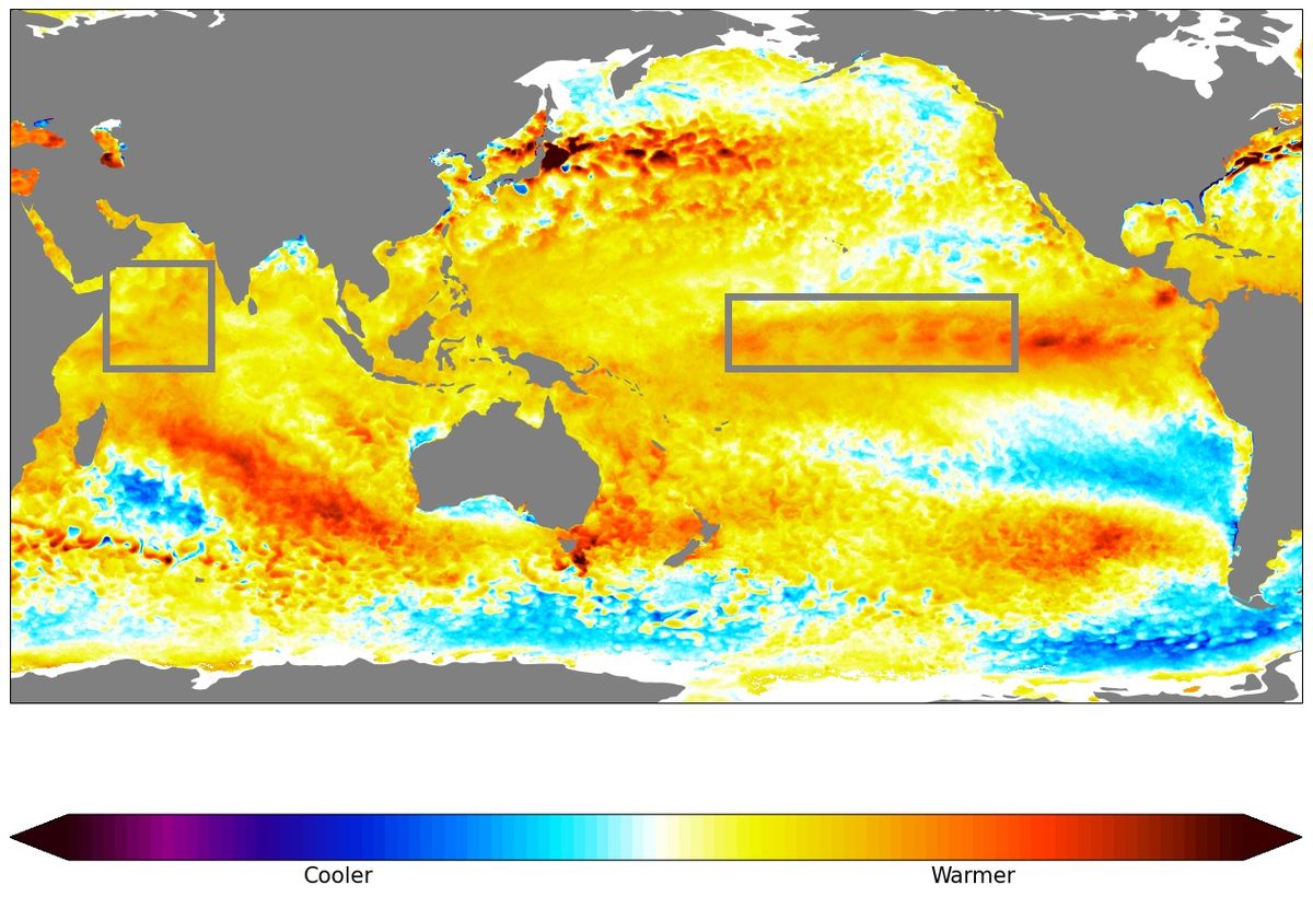
El Nino? Yes. We are firmly in the phase of the Pacific Ocean known as El Nino. This is characterised by warmer than average water out in the middle of the Pacific. This is a global pattern that works to reduce the moisture available for Australia.
But, and it’s a big but, the Pacific isn’t the only driver of our weather.
Look at how incredibly warm the Tasman Sea is between Australia and New Zealand. That rapidly developed in October and has been with us ever since, acting as a very rich source of moisture to fuel our weather systems.
Our Oceans - How much warmer or cooler than average. The red Pacific box indicates El Nino, but the incredibly warm Tasman Sea between Australia and New Zealand is our new source of moisture and overrides the drying effects of the Pacific.
The potential rain image (the first in this article) shows day after day of rain across much of northern Australia.
The monsoon has arrived (a bit late thanks to El Nino).
We’re now in an active phase of tropical activity that should last until the end of the month and possibly into early February.
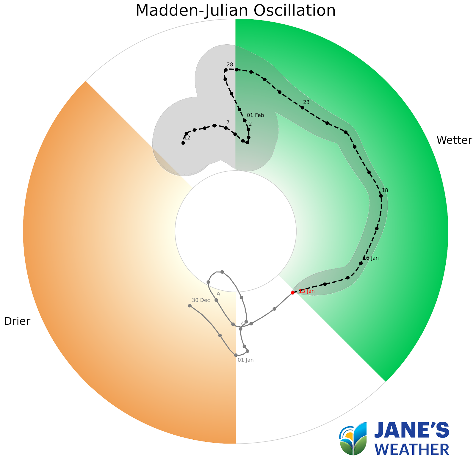
When the a tropical pulse, known as the Madden-Julian Oscillation, is in the green zone, Australia has the action.
The Madden-Julian Oscillation tells us when the Australian tropics are likely to be active - and the pulse is in our part of the world (green zone) until the end of January. This increases wet weather in the north, and the risk of Cyclones. It can also feed weather systems travelling across southern Australia if they line up.
This heightened tropical activity also increases the risk of tropical cyclones.
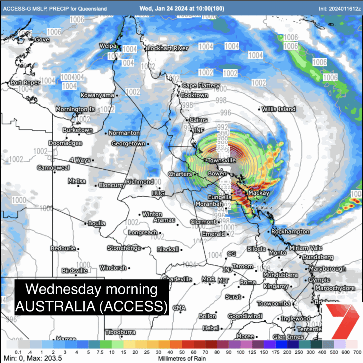
Next week’s weather pattern should encourage development of one off the Queensland coast.
This is very early days and you will want to keep a close eye on the guidance as we go through next week, to see if the coast may be impacted, and in which area.
I’ve included each of the weather models guidance, as of this morning, to show the potential paths at this stage.
The Australian model has a crossing next Wednesday morning, the US model has a crossing next Thursday night, the Euro model doesn’t have a crossing by Friday night (the end of the forecast period), and the Canadian model has it remaining out to sea. As you would expect this far out, they all say something different.
Again, very early days. Watch for consensus amongst the models as the window approaches.
Each of the weather models showing the different location of a potential cyclone later next week.
See how conditions are most likely to unfold at any property across Australia with Jane’s Weather.
We combine all the different weather modelling into one easy to use forecast, and update you as soon as the next guidance is issued.
Easily see hour by hour what is most likely to occur at your place over the next 10 days.


A moderate cold front continues to slowly move through the southwest third of WA with moderate to heavy falls via thunderstorms along the coast and...

A quiet weather pattern continues for much of the country this week with ridging in place over much of the continent and only the northern tip of...

It is a quiet weather week across the country, with a new large high moving into place, this leading to settled conditions this weekend and next...