 Jane Bunn - Jane's Weather
Settled conditions this week, drier outlook continues to build
It is a quiet weather week across the country, with a new large high moving into place, this leading to settled conditions this weekend and next...
We've moved into a phase of weather with limited connection to tropical moisture, an ending Negative Indian Ocean Dipole, and a weak La Nina - so the significant rain systems of the past few months are less likely for now.
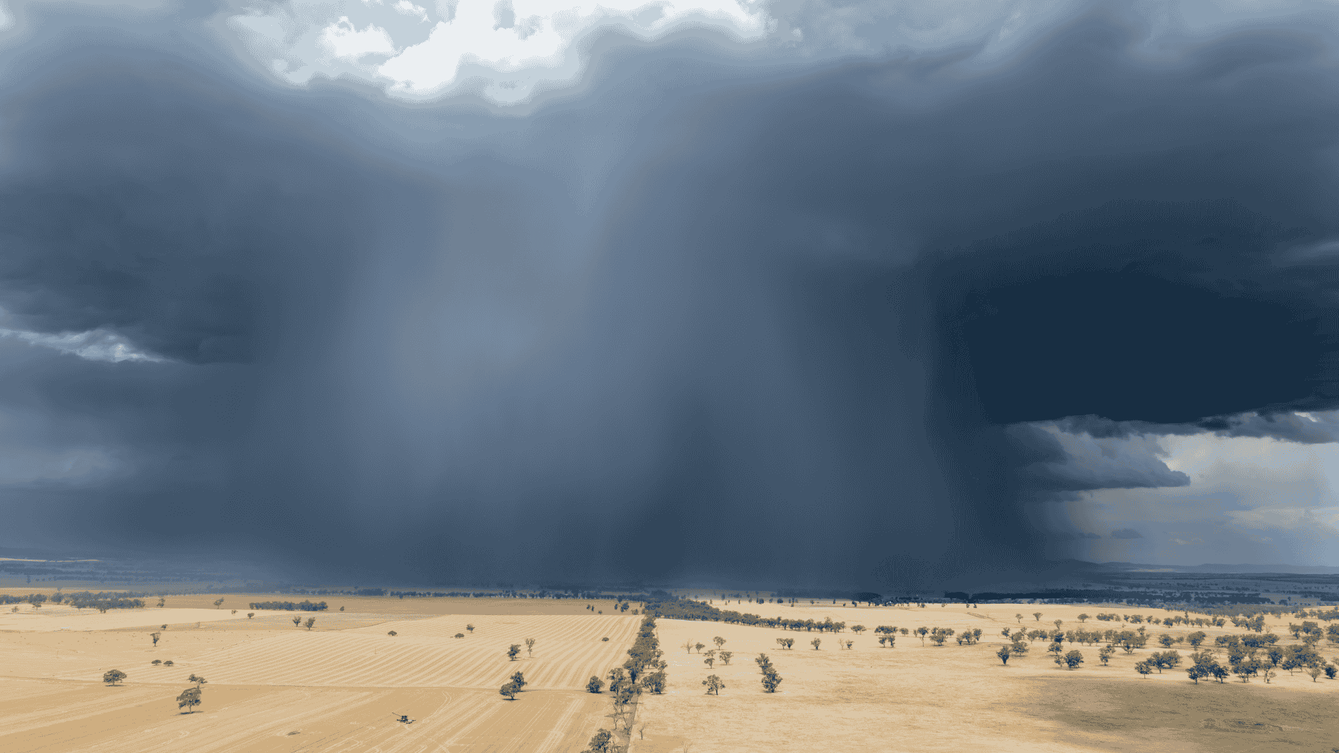
That is highlighted in this morning's satellite image which shows the vast majority of the country cloud free. Heatwave conditions are prevalent across the north and dipping down into the southeast, set to slowly retreat northwards in the east across the weekend.

Yet another cold outbreak reaches the southeast on Saturday, quickly thawing into early next week. Wet weather increases on Sunday in Queensland and NSW and continues into Monday before a break on Tuesday. Then it may pick up again there from Wednesday onwards.

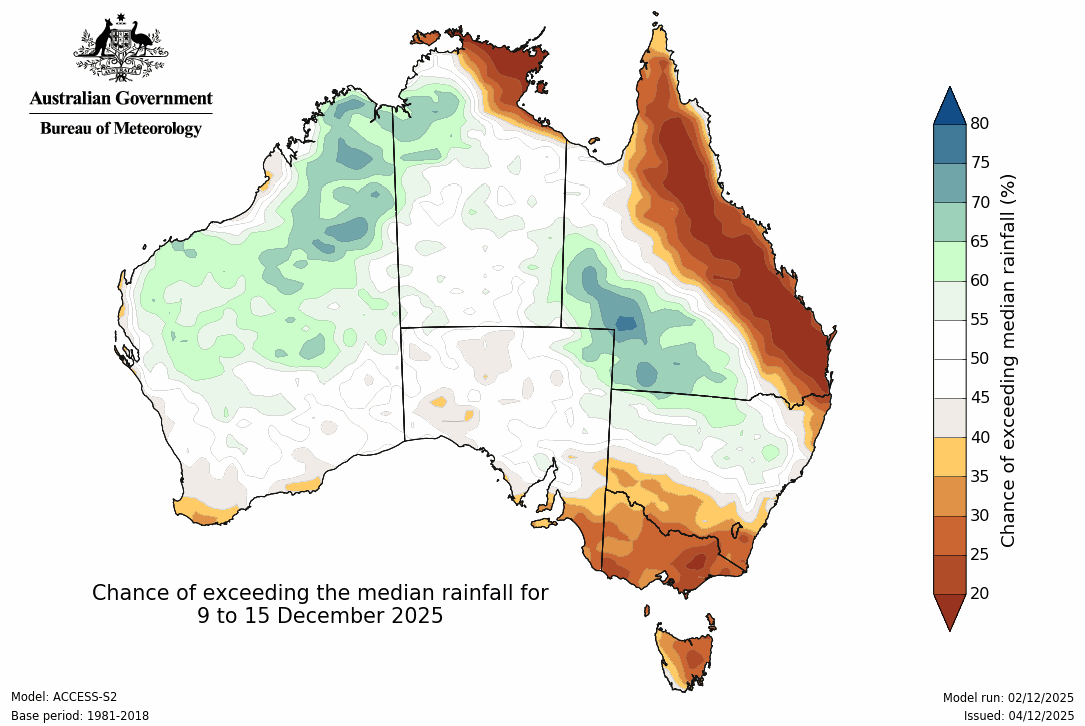
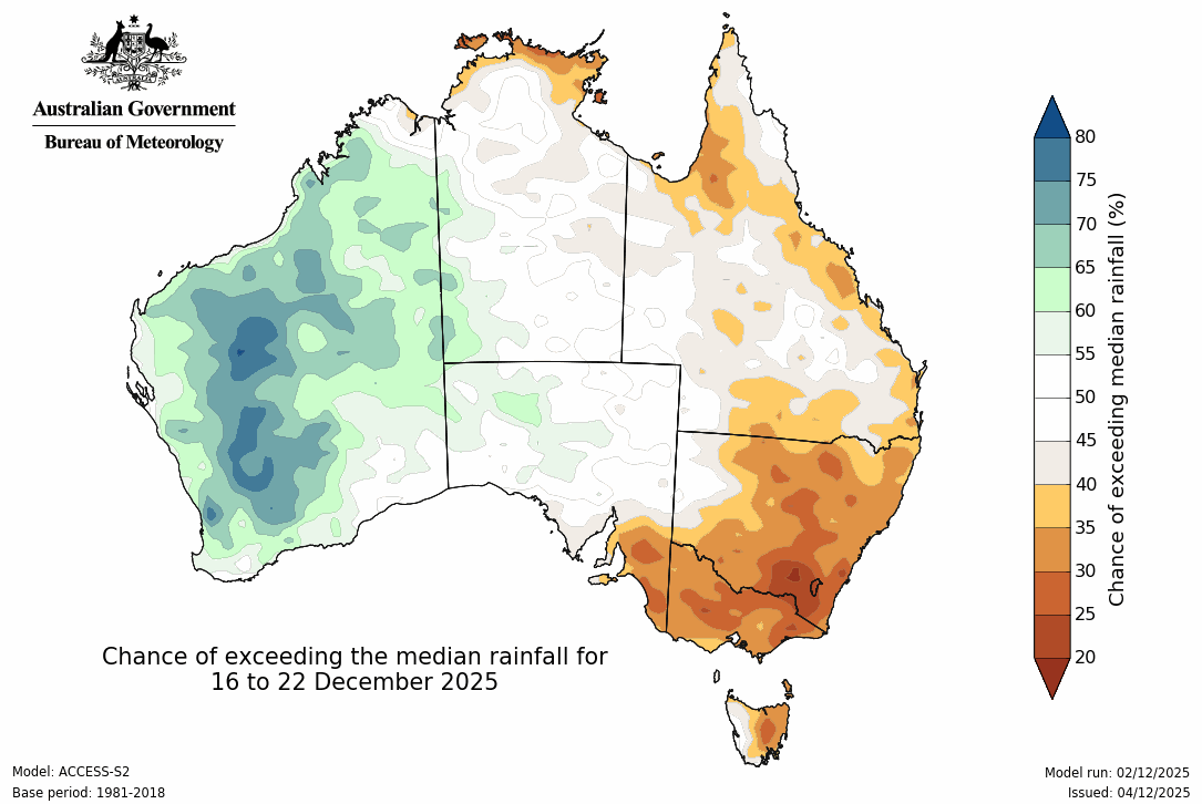
Looking longer term, and there is an area of rain possible over inland Queensland and northern NSW (from Wednesday next week), otherwise things are looking on the dry side in the east. The activity focuses on the northwest, and may spread down into the southwest in the week beginning December 16th - while all parts of the east look quite dry.
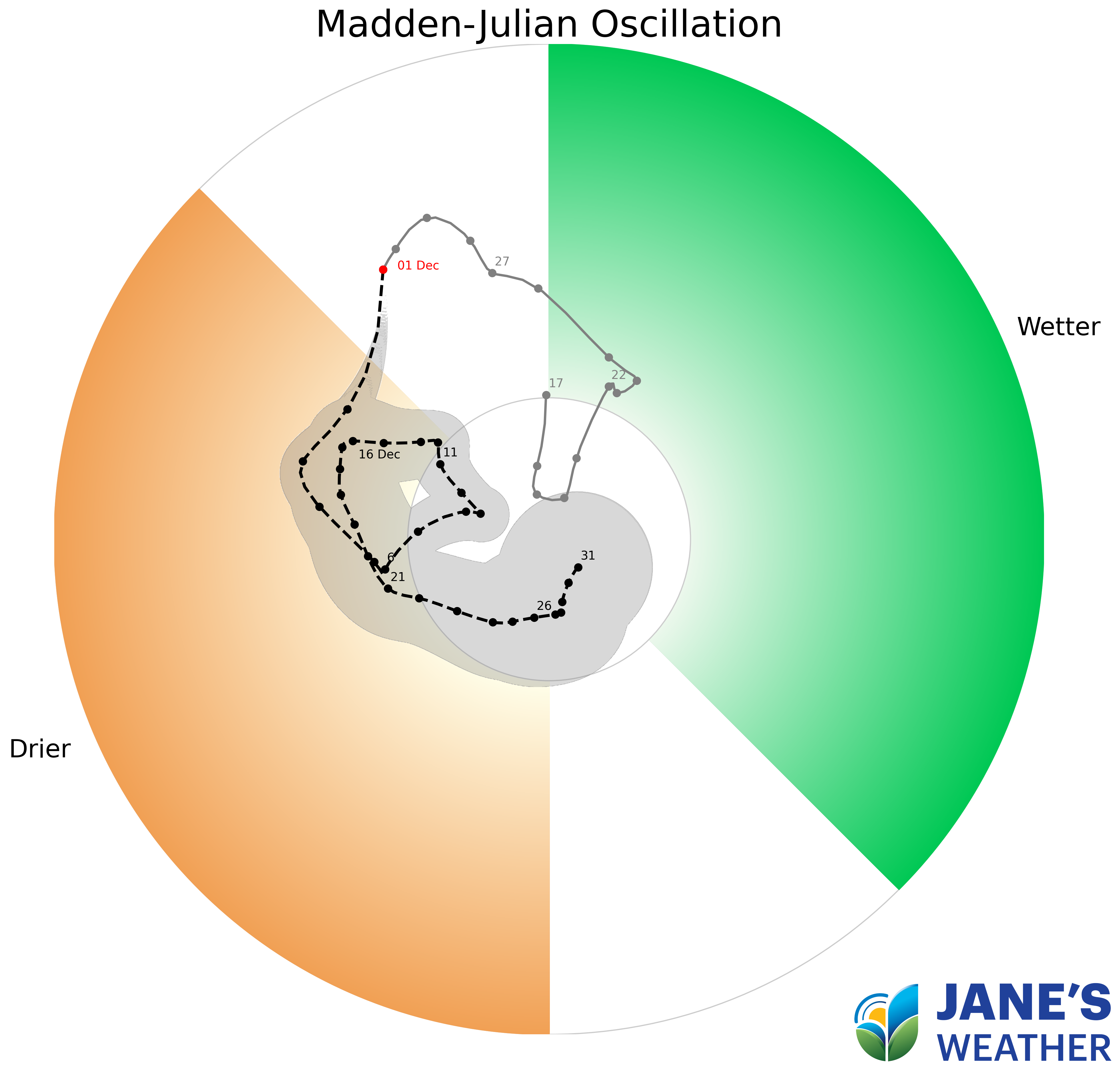
One of the instigators for this lack of tropical connection is a climate driver known as the Madden-Julian Oscillation (MJO). This pulse of energy travels around the globe at the tropics, creating activity where it passes, and suppressing activity on the other side of the world. For December this pulse is taking a holiday away from Australia, which is why our weather patterns have changed. We still have a weak La Nina, but we need something to get that going to see the big rainfalls from it - and for the next few weeks we don't seem to have that connection.

Jane’s Weather provides hyper local weather forecasting based on the consensus of all the weather models, using Machine Learning and AI to calibrate the forecast to conditions at your farm. We include updates on temperature, rain and wind, along with evapotranspiration for efficient water usage, frost risk, growing degree days and a detailed spraying forecast customised for any property in Australia.

It is a quiet weather week across the country, with a new large high moving into place, this leading to settled conditions this weekend and next...

Another well timed upper low and trough working through a warm and moist airmass triggered by a positive SAM phase continues to headline the week of...
Great to see a nice full tank of moisture for much of SA and southern WA following a significant week of rainfall with a slow moving low pressure...