 Jane Bunn - Jane's Weather

Frosts intensify and spring heat looms as El Nino signals build
Another quiet week of weather is on the way. The coverage and strength of the frontal weather is expected to be more of a feature for those exposed...

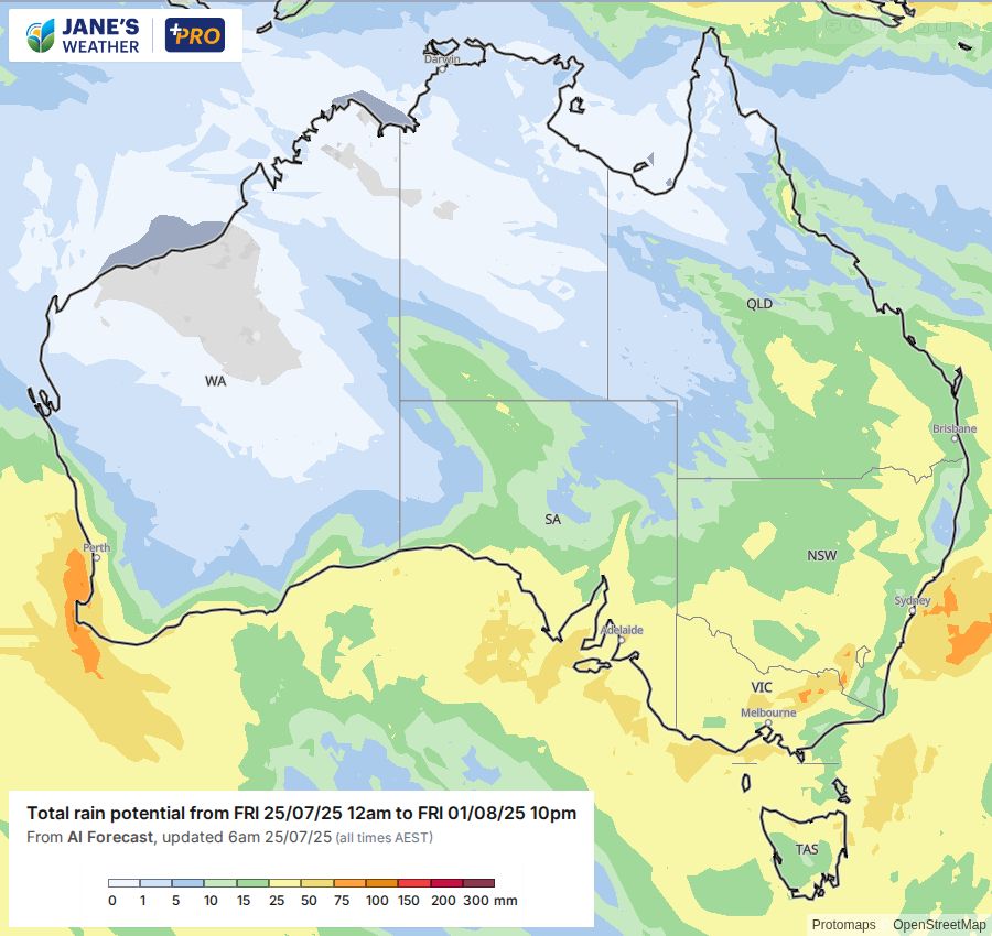
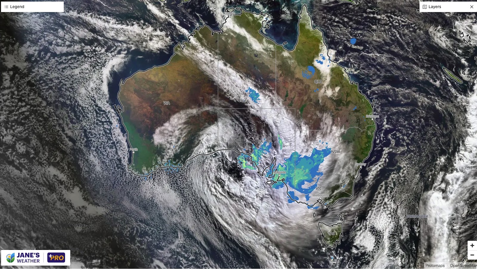
This widespread rain event is affecting every state and territory, and this weekend brings rain from the top of Queensland to the bottom of Tasmania.It's weekly update time, and what a time to give an update. The big, juicy, northwest cloudband is in full swing, connecting a feed of tropical moisture with a huge cold front and a cut off low - all slowly moving eastwards giving a huge part of Australia a soak.
This brings a widespread 15 to 25 mm, but generally 25 to 50 mm to a huge area. All on the western side of the ranges (with the east being the dry side this time).
It began in the west mid-week, moves across central parts today, then into the east on the weekend - and when this is done it will have affected every single Australian state and territory.
This is the big one, but there is yet another system to follow next week. Likely to take a slightly northern path (see the video at the end of this article). This one doesn't have the same big moisture feed but it is likely to bring a nice follow up.
Potential rainfall over the next week.
The current weather system is a classic, textbook example of what a Negative Indian Ocean Dipole can do for us.
The Negative phase is the Indian Ocean equivalent of a Pacific Ocean La Nina (just without the fancy name). These phases actively push moisture towards Australia. We see these phases when the boxes in the Sea Surface Temperature Anomaly map turn blue.
That is just one part of the rainfall equation though - you also need instability to turn that into rain - and the rain only affects those that are in the right spot for that weather system.
Sea Surface Temperature Anomaly
For an in depth look at all that is happening with our weather, here is my weekly update video. 17 minutes today as there is a lot to cover!

Jane’s Weather provides hyper local weather forecasting based on the consensus of all the weather models, using Machine Learning and AI to calibrate the forecast to conditions at your farm. We include updates on temperature, rain and wind, along with evapotranspiration for efficient water usage, frost risk, growing degree days and a detailed spraying forecast customised for any property in Australia.

Another quiet week of weather is on the way. The coverage and strength of the frontal weather is expected to be more of a feature for those exposed...

The weather pattern is generally stable and with more high pressure on the horizon, this is indicative of the El Niño that is starting to influence...

A moderate cold front continues to slowly move through the southwest third of WA with moderate to heavy falls via thunderstorms along the coast and...