 Jane Bunn - Jane's Weather
Settled conditions this week, drier outlook continues to build
It is a quiet weather week across the country, with a new large high moving into place, this leading to settled conditions this weekend and next...

This week’s update focuses on drought in southeastern Australia - and a somewhat promising rain outlook.
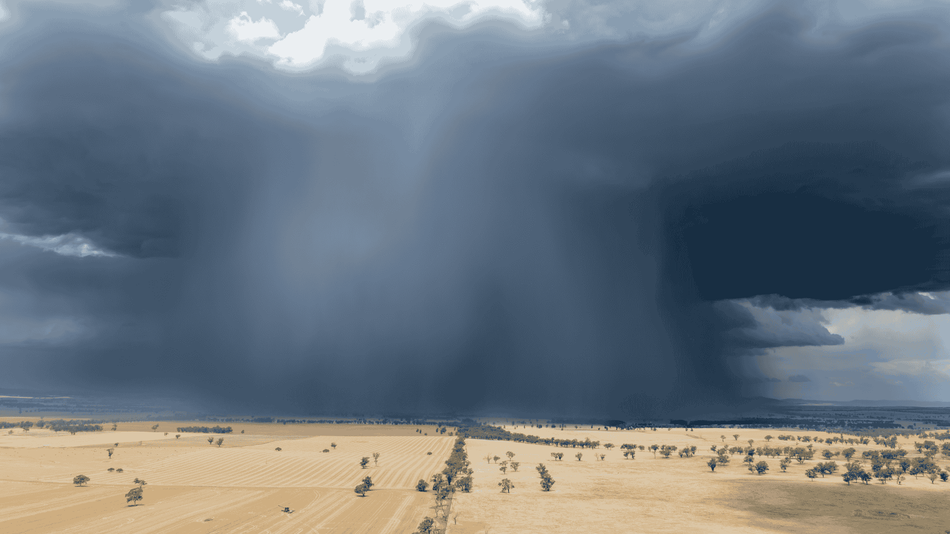
If we look back over the past 12 months, conditions are incredibly dry across the following parts of southern Australia - mainly in southern South Australia and western Victoria, but also parts of southern Western Australia, and the west coast of Tasmania. There has been occasional rainfall, and some big downbursts (that perhaps caused more damage than help) but overall, rainfall totals are very much reduced from average.

In the past week, Cyclone Alfred produced huge rainfalls near the coast in southeast Queensland and northeast NSW. Some rain from the remains spread through parts of NSW and VIC, and even Tasmania, while the usual-to-reduced rainfall continued in the north.
READ MORE: TOM'S MARKET MUSTER: Steer price gap tightens, cyclone slows slaughter, and US trade tensions

Over the next week, there is a significant rain system.
Its timing is Friday to Monday - the early part of the outlook - which gives us higher confidence in it.
This rain system provides good falls for southern parts of WA on Friday, then moves to the southeast on Sunday into Monday.
Widespread 10 to 25 mm, with locally heavier falls, and significant falls in western Tasmania.
However, take a close look at the map - much of South Australia's southeast misses out, along with northern Victoria.

Looking further ahead, and next week (beginning Monday, March 17) is looking drier than average across much of southern Australia. Rain systems further north may tease the south at times, but high pressure is likely to get in the way and not let the rain through.

But, looking ahead to week two (beginning Monday, March 24) paints a different picture. There is a chance that a big rain system from the north will sweep down into the south, across South Australia, Victoria, southern NSW and northeast Tasmania.
This is thanks to the MJO returning to Australia after an extended break (a pulse of energy that travels around the tropics enhancing rainfall), and lining up with a proper weather system to funnel that rain southwards.

As always, guidance that is more than a week away needs to be treated with caution. There are a lot of things that need to line up to allow this rainfall to occur. But it is one to watch closely as we approach this window.

Jane’s Weather provides hyper local weather forecasting based on the consensus of all the weather models, using Machine Learning and AI to calibrate the forecast to conditions at your farm. We include updates on temperature, rain and wind, along with evapotranspiration for efficient water usage, frost risk, growing degree days and a detailed spraying forecast customised for any property in Australia.

It is a quiet weather week across the country, with a new large high moving into place, this leading to settled conditions this weekend and next...

Another well timed upper low and trough working through a warm and moist airmass triggered by a positive SAM phase continues to headline the week of...
Great to see a nice full tank of moisture for much of SA and southern WA following a significant week of rainfall with a slow moving low pressure...