 Jane Bunn - Jane's Weather
Settled conditions this week, drier outlook continues to build
It is a quiet weather week across the country, with a new large high moving into place, this leading to settled conditions this weekend and next...

Pressure patterns are changing and the Indian Ocean is shifting into gear, with the potential for a widespread rain system in a few weeks.
I'm paying particular attention to the pressure map today, because there is something important going on.
High pressure has moved north for the winter - the centre is over the Carnarvon to Alice Springs to Brisbane type latitude - and this positioning lets all the Southern Ocean cold fronts hit southern Australia.
Some peak nearby and bring a decent rainfall, others slide and bring just a little. Some have a feed of tropical moisture and deliver big widespread rain.
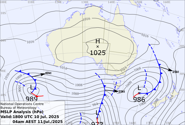
Over the next week, we'll have front after front cross some part of the south - and there is no end in sight to this weather pattern.
There is an anomaly - next Monday/Tuesday - a cold pool moves over SA and western NSW delivering a nice 5-10mm. Not huge, but nice.
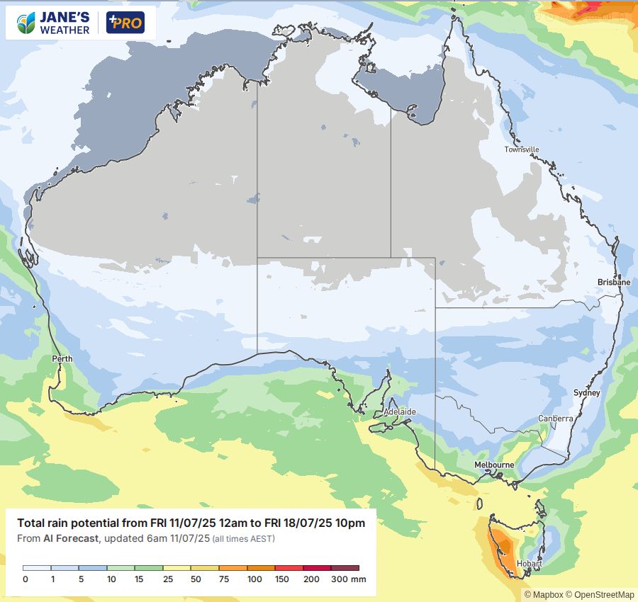
Early indicators for the following week (beginning July 22) show the potential for Indian Ocean moisture to sweep down across the country - in the form of a 'juicy northwest cloudband'. If this connects with one of the fronts (or a trough or low) it will do very nice things for those in its path. One to watch.
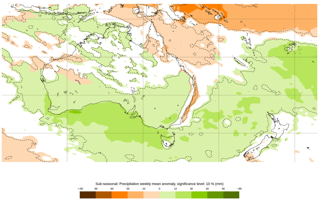
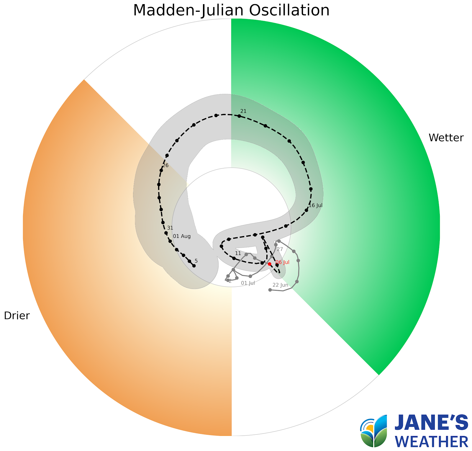
This tropical connection is helped by a driver known as the MJO - which may be nice enough to do a 'drive by' (cross the green zone) during mid July.
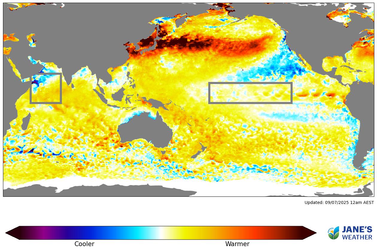
Finally, I can't not show the global SSTA map - how much warmer or cooler the top of the ocean is.
The blue in the Indian Ocean box continues to grow and that continues to make me smile, as I'm sure it does for you.
This is the instigator of more 'juicy northwest cloudbands', and the potential for widespread rain. It also helps the highs move out of the way, something we were cursed with last year that stopped the rain and produced the drought.
Don't miss the full update where I walk you through each of these graphs and more - perfect if you have precisely 16 minutes to spare.

Jane’s Weather provides hyper local weather forecasting based on the consensus of all the weather models, using Machine Learning and AI to calibrate the forecast to conditions at your farm. We include updates on temperature, rain and wind, along with evapotranspiration for efficient water usage, frost risk, growing degree days and a detailed spraying forecast customised for any property in Australia.

It is a quiet weather week across the country, with a new large high moving into place, this leading to settled conditions this weekend and next...

Another well timed upper low and trough working through a warm and moist airmass triggered by a positive SAM phase continues to headline the week of...
Great to see a nice full tank of moisture for much of SA and southern WA following a significant week of rainfall with a slow moving low pressure...