South may see rain relief next weekend as the stubborn dry pattern shows early signs of shifting
It feels like Ground Hog day across the continent at the moment as a blocking pattern remains fixed over the southeast parts of the nation, blocking...
2 min read
 Jane Bunn - Jane's Weather
:
Oct 4, 2023

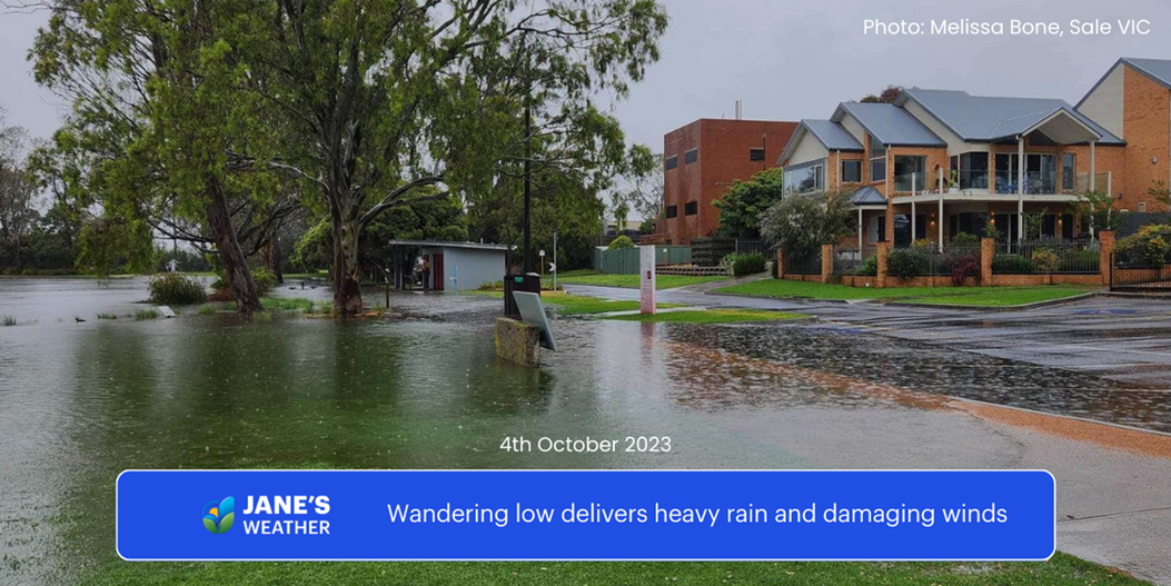
As I write this on Wednesday morning, parts of Victoria’s eastern ranges have just ticked over 200mm into the rain gauge.
A “cut-off” low is forming on a stalled cold front running through the eastern states. “Cut-off” because it is not connected to the fast westerly winds south of the continent that would usually whisk it away.
Instead, we’re left with a slow moving low that really likes the look of southern NSW and eastern VIC, taking a leisurely scenic trip delivering heavy rain to those in its path.
 Above: potential rainfall from Wednesday 4th to Saturday 7th.
On Wednesday the large area of widespread rain with heavy falls is gradually moving eastwards, and on Thursday the cut-off low will pop out off the coast of southern NSW. This movement means the low will have a sting in its tail, and both southeast NSW and southeast VIC are in line for one last hurrah of heavy rain and damaging winds on Thursday morning.
Then it's all over as the low wanders away.
You’ll notice that within the eastern states, the following areas miss out on the heavy rain: western VIC, much of TAS, northeast NSW and all of QLD. The low doesn’t take a path through these parts, so there’s no heavy rain there.
The low does leave behind a calling card of sorts - known as an upper level trough. That’s responsible for the wintry hail over SA today, and alpine snow in the southeast tomorrow.
This is essentially a large area of energy that will linger over the eastern states through to the weekend, and encourage showers and thunderstorms in the following inland parts of QLD and northern NSW from Sunday. If you are directly underneath one of these storms it can bring localised heavy rain, but this isn’t widespread like we see from the cut-off low.
 Above: potential rainfall from Sunday 8th to Wednesday 11th.
So, what happened to the “overall hot and dry” that we expect from El Nino and a Positive Indian Ocean Dipole?
That hasn’t changed, we’re still hot and dry overall, whenever we don’t have an anomalous low wandering through.
The pool of heat over the interior is still there, a trademark of El Nino, and whenever the wind blows from the interior we’ll heat up again.
This heat visits the west for the remainder of this week and gradually rolls back into the east next week (after a period of cool in the wake of the cut-off low and upper level trough).
 Above: next week's temperature anomaly (red indicating hotter than average overall, and blue indicating colder than average overall).
See what weather is most likely at your property, hour by hour for the next ten days, along with our customisable insights highlighting the impacts on your operations, with our precise and actionable forecasts at Jane’s Weather.
Sign up for personalised alerts to stay ahead of what weather is on its way.
Our notifications include temperatures, rain and wind, along with evapotranspiration, frost risk, growing degree days and a spraying forecast, customised for any property in Australia.
Posts By Tag

It feels like Ground Hog day across the continent at the moment as a blocking pattern remains fixed over the southeast parts of the nation, blocking...

Another relatively quiet week of weather for the nation under the stable influence of the ridging continues into yet another week ahead. The second...

The seasonal transition continues across the nation with ridging becoming more dominant in the upper and lower levels and the drier airmass being...