 Jane Bunn - Jane's Weather
Frosts intensify and spring heat looms as El Nino signals build
Another quiet week of weather is on the way. The coverage and strength of the frontal weather is expected to be more of a feature for those exposed...

The leftover moisture from Cyclone Fina is meeting up with a trough over the centre of the country and it is set to spread significant rain across much of the southeast this weekend.
Southeast SA, much of Victoria, southern NSW and parts of Tasmania will see the most from this - and it is followed by another cold outbreak on Sunday to Tuesday. In total we are looking at 10 to 25 mm for the majority of the southeast, with large areas seeing 25 to 50 mm.
Meanwhile, the storm triggering troughs are taking a break over southeast Queensland on Friday, but it is set to return for Saturday. This is another outbreak of severe storms, but the activity should slowly contract northwards from Sunday into early next week. Then there is a lengthy stretch of settled weather, without the extreme heat.
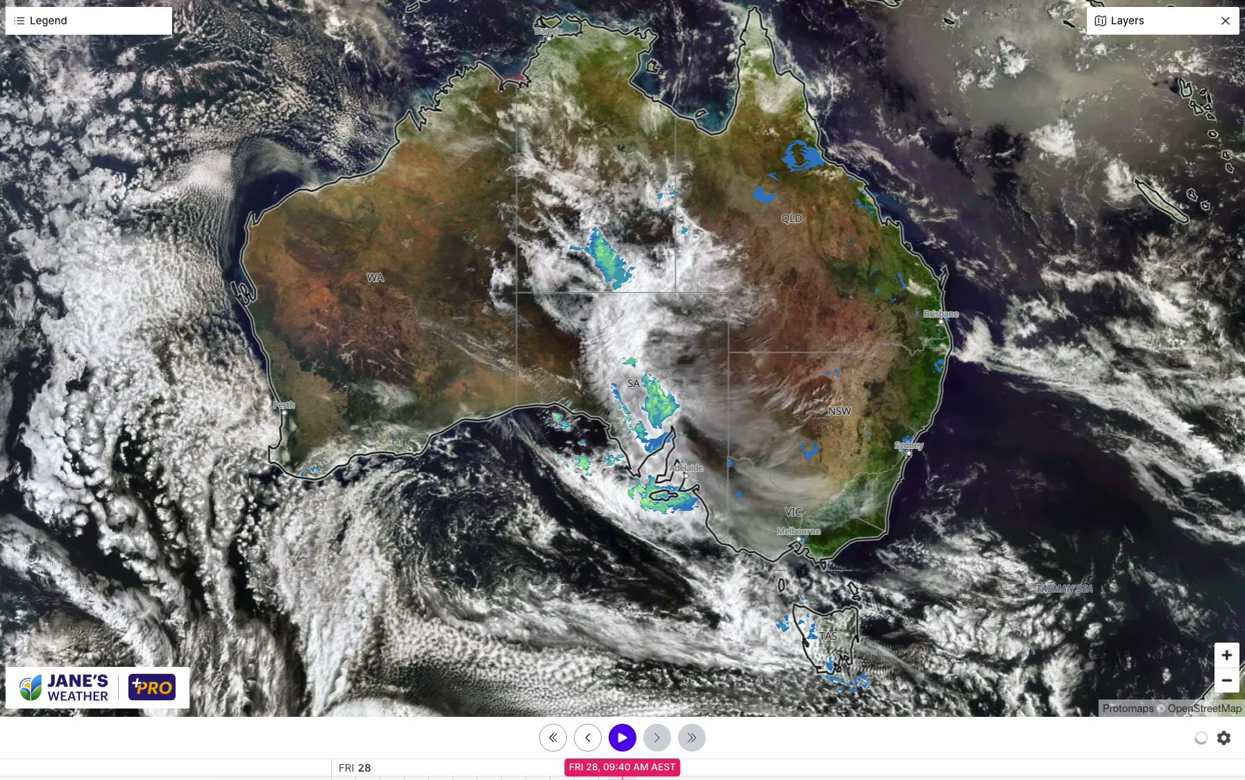
Satellite and radar on Friday morning.
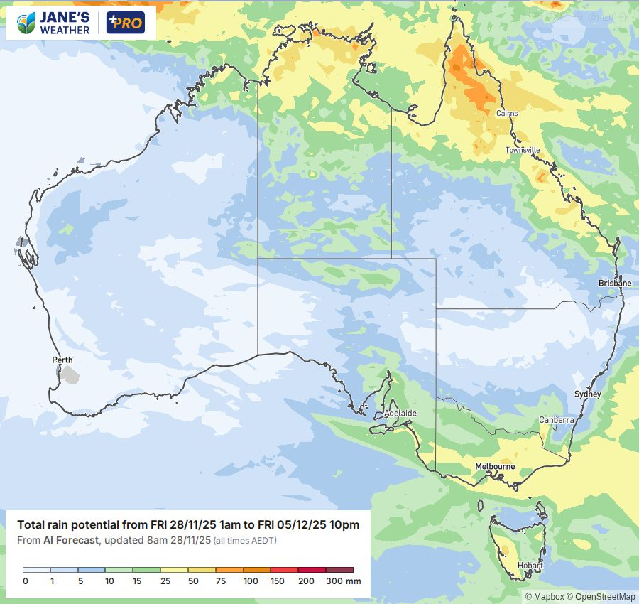
Potential rainfall over the next week.
The weather pattern has a shake up mid next week, and for the next two weeks there is a dry signal over much of the country.
The focus of wet weather shifts to the west during the week, while high pressure covers the east encouraging drier than average conditions. BoM's outlook suggests that drier than average is likely for the majority up until mid-December.
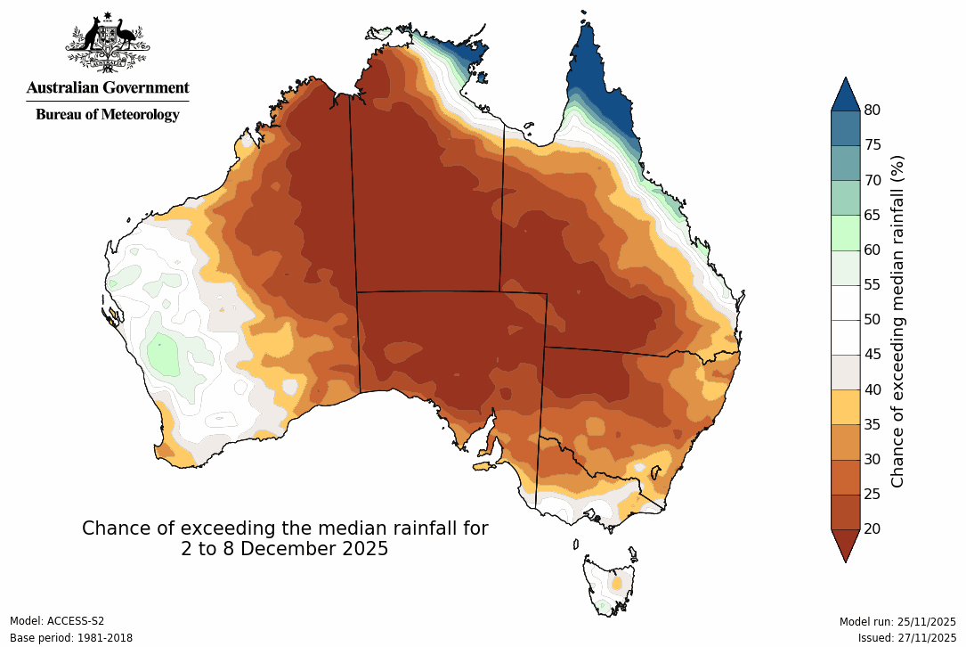
BoM's outlook for 2 - 8 December is drier than average for much of the nation
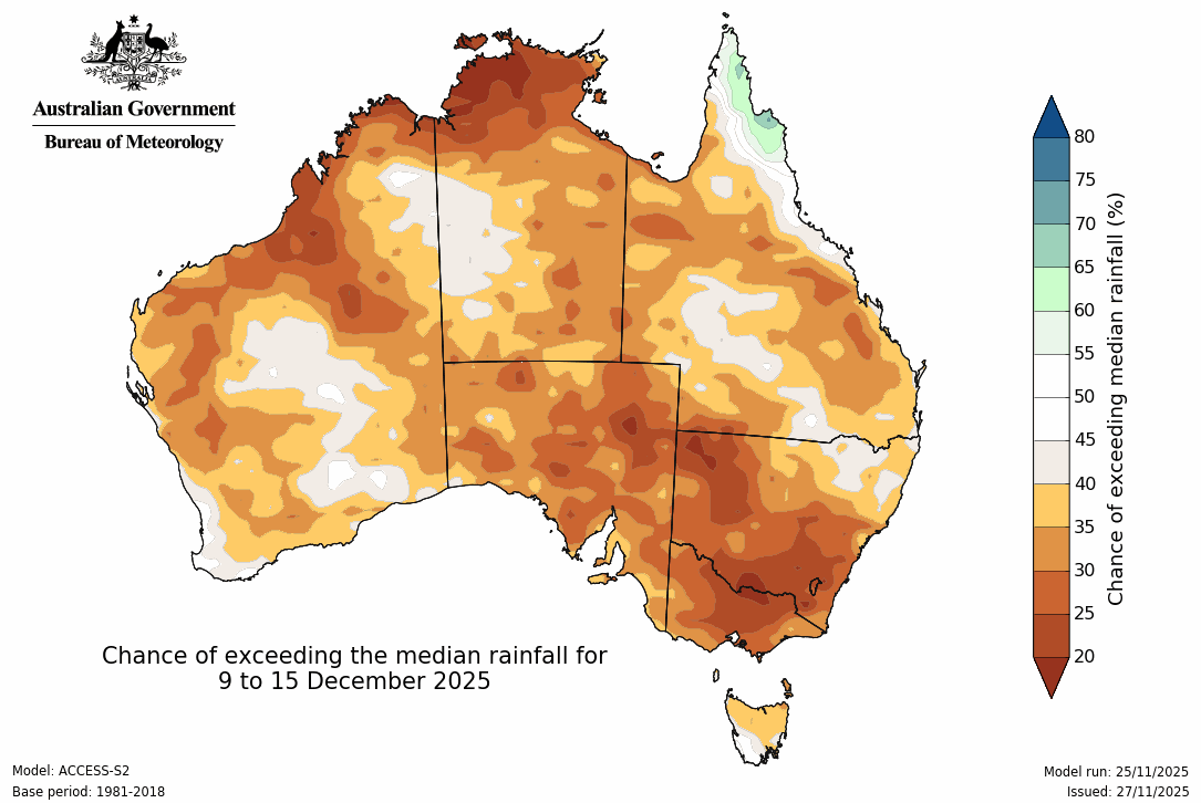
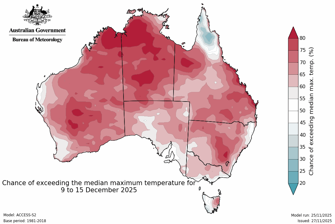
The dry trend continues the following week, 9 - 15 December
Our temperatures are a different story.
A cold outbreak arrives in the southeast early next week, putting the southeast into a chill, and relieving the heatwave conditions further north. Instead the heat heads west, as high pressure moves through.
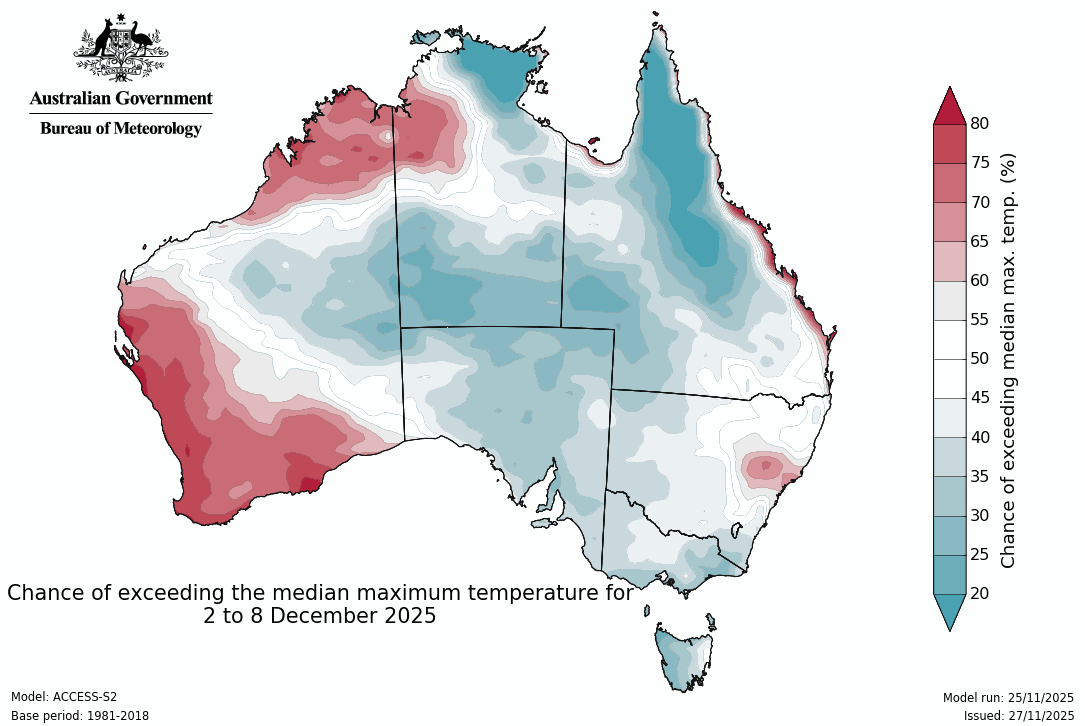
Milder conditions across much of the east and central parts from 2 - 8 December

Jane’s Weather provides hyper local weather forecasting based on the consensus of all the weather models, using Machine Learning and AI to calibrate the forecast to conditions at your farm. We include updates on temperature, rain and wind, along with evapotranspiration for efficient water usage, frost risk, growing degree days and a detailed spraying forecast customised for any property in Australia.

Another quiet week of weather is on the way. The coverage and strength of the frontal weather is expected to be more of a feature for those exposed...

The weather pattern is generally stable and with more high pressure on the horizon, this is indicative of the El Niño that is starting to influence...

A moderate cold front continues to slowly move through the southwest third of WA with moderate to heavy falls via thunderstorms along the coast and...