 Jane Bunn - Jane's Weather
Frosts intensify and spring heat looms as El Nino signals build
Another quiet week of weather is on the way. The coverage and strength of the frontal weather is expected to be more of a feature for those exposed...

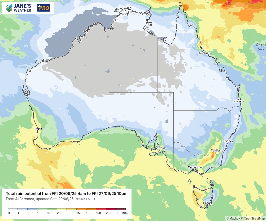
Over the course of the next week we have significant rain across much of southern Australia.
The second major rain system in the west in a week is affecting those parts today and across much of the weekend. Significant falls for both the west and south coast (thanks to a one-two punch coming from different directions), with lighter but still decent falls extending well inland.
Then the focus shifts to the southeast.
The first system slides across the southeast later Sunday and on Monday. The second pushes in from the west on Tuesday into Wednesday, and there are falls that linger through to Thursday.
Not quite as significant as the long weekend rain system (that was a slow moving cut off low, while this is a series of cold fronts with the driving low well south of the mainland) - but still bringing very handy rainfalls for much of the southeast.
Another out of season rain system may impact northeast Queensland from late next week.
Potential rainfall over the next week.
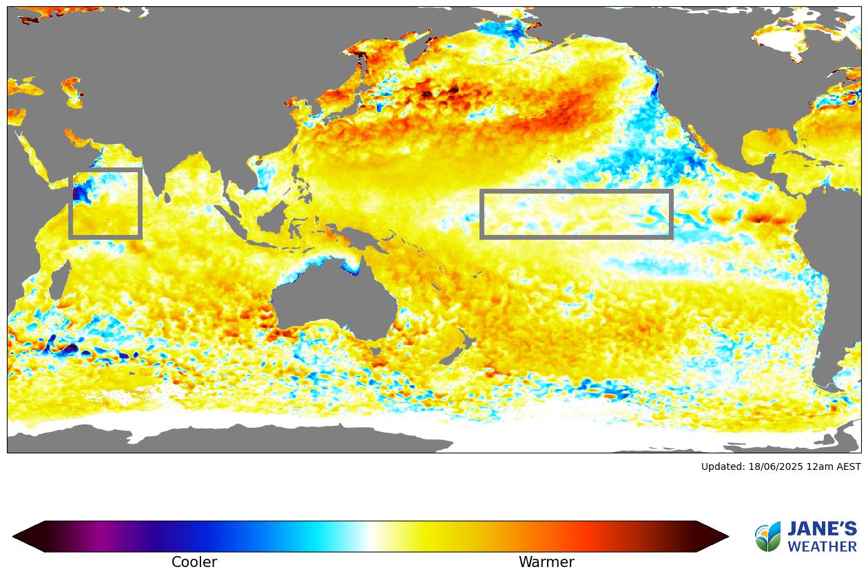
If you've been tracking our developing Negative Indian Ocean Dipole (IOD) as closely as I have, you will have noticed that the areas of blue-to-purple in the Indian Ocean box have turned rapidly darker over the past few days.
The Ocean had briefly stalled but this indicates it is getting back on track.
Sea Surface Temperature Anomaly.
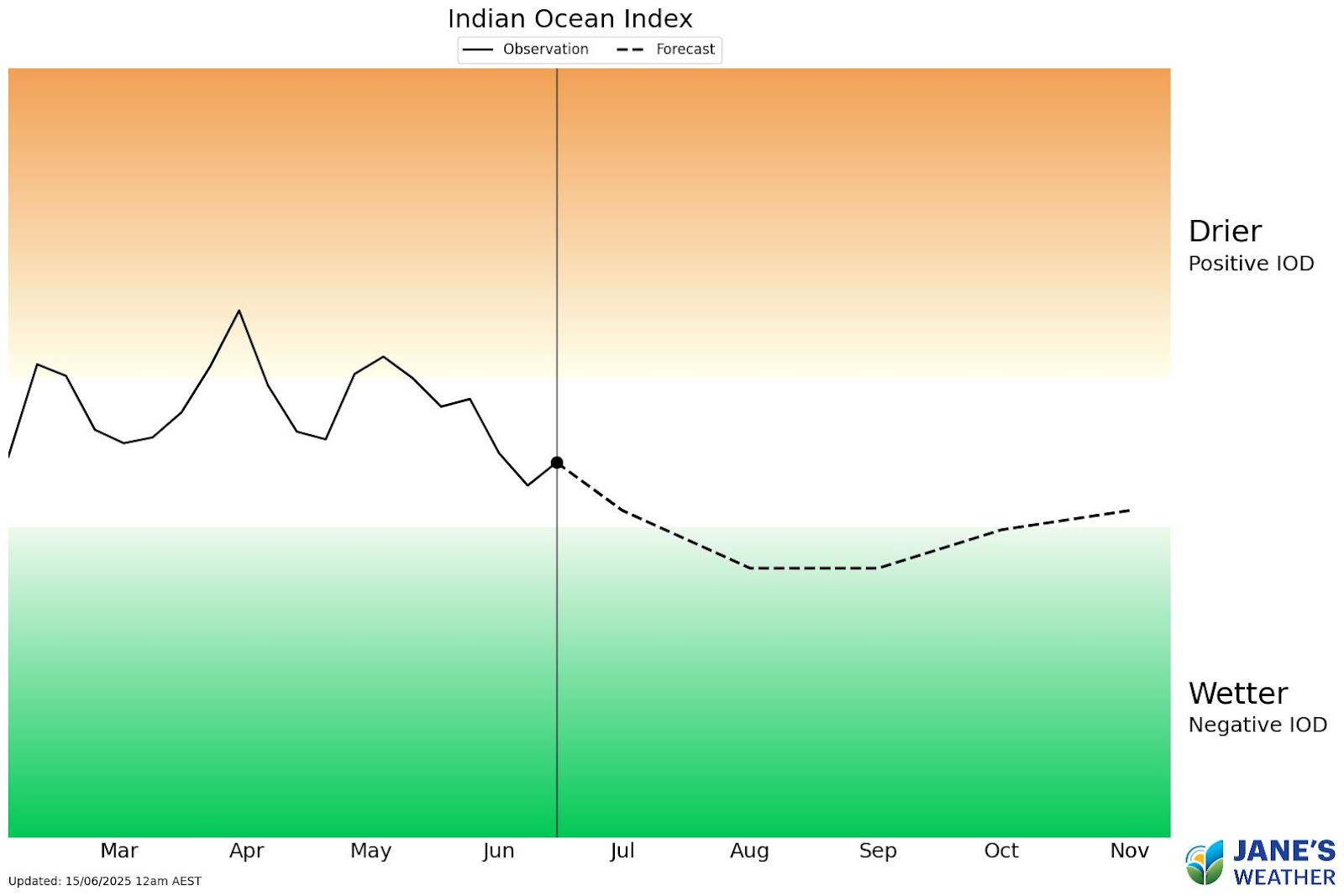
Indian Ocean Dipole observations and forecast.
The Indian Ocean index updates only once a week (still showing the stall), but the update early next week could be closer to the threshold.
Crossing this threshold will encourage moisture to be pushed towards Australia over the later part of winter and early to mid part of spring. A key ingredient in the rainfall equation (moisture + instability = rain).
Now, it's up to the low pressure systems to spread that rain to where it is needed most.

Jane’s Weather provides hyper local weather forecasting based on the consensus of all the weather models, using Machine Learning and AI to calibrate the forecast to conditions at your farm. We include updates on temperature, rain and wind, along with evapotranspiration for efficient water usage, frost risk, growing degree days and a detailed spraying forecast customised for any property in Australia.

Another quiet week of weather is on the way. The coverage and strength of the frontal weather is expected to be more of a feature for those exposed...

The weather pattern is generally stable and with more high pressure on the horizon, this is indicative of the El Niño that is starting to influence...

A moderate cold front continues to slowly move through the southwest third of WA with moderate to heavy falls via thunderstorms along the coast and...