 Jane Bunn - Jane's Weather
Spring preview for some as weather changes
A moderate cold front continues to slowly move through the southwest third of WA with moderate to heavy falls via thunderstorms along the coast and...

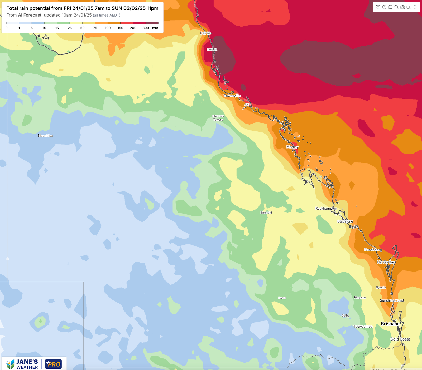
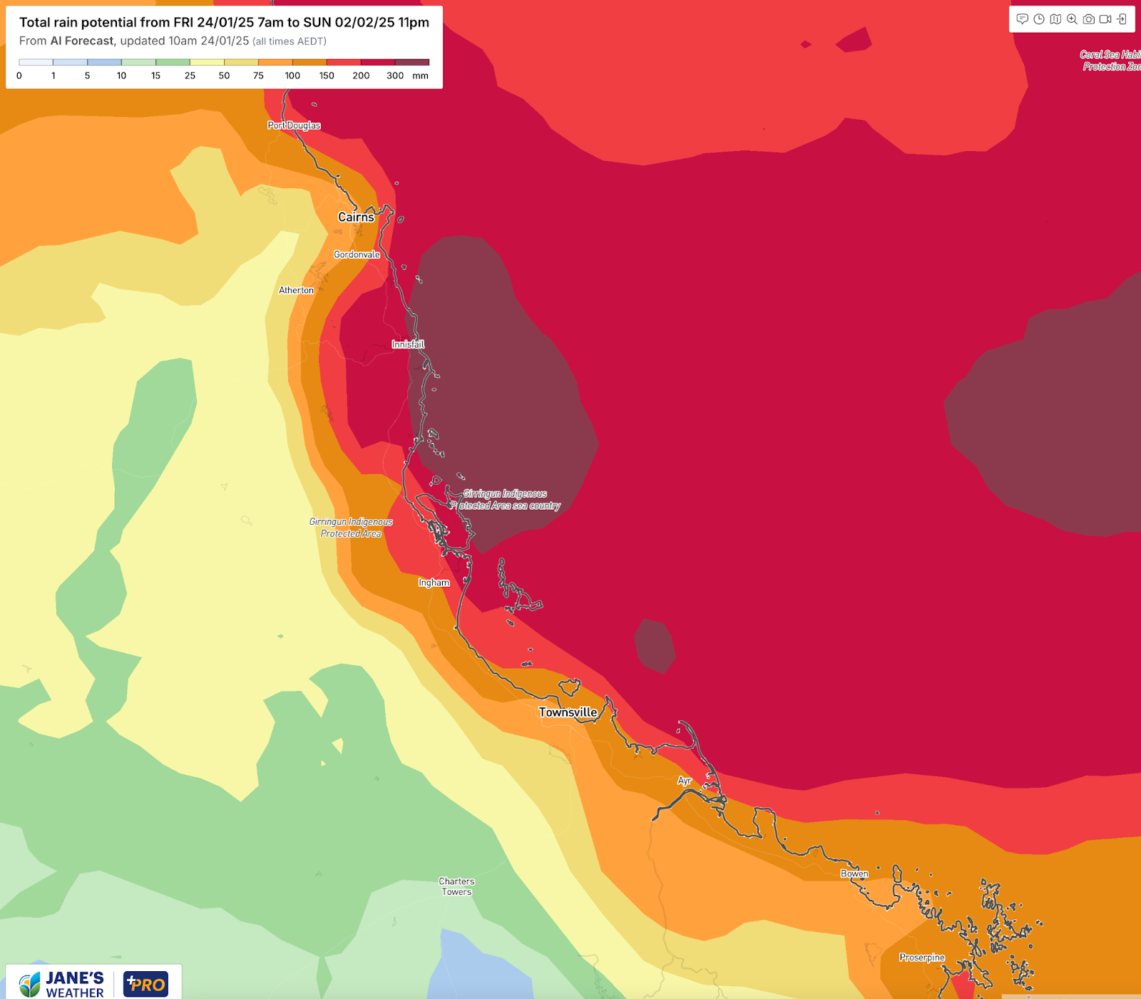
A persistent weather pattern begins on Sunday and lasts through much of next week, continuously pushing rain into the northern Queensland coast. Widespread falls over 200mm are likely.
We’re about to experience a type of weather system that isn’t as dramatic as a tropical cyclone or strong cold front, but still has a big impact on our weather.
The weather map won’t show much, just a boring looking trough on the northern Queensland coast.
But this will have a big impact for those of us living and working in the area, as it brings day after day of moist onshore winds, running into the instability of the trough, producing rainfall over a large area.
Over the course of three to five days, beginning on Sunday, a large part of the northern Queensland coast is likely to see more than 200mm.
Within this activity there are always locally heavier falls - that could top out over 400mm.
Total potential rainfall through shows the risk of more than 200mm along a large part of the northern Queensland coast.
Consensus amongst all the different model guidance is quite good at this stage (which gives us higher confidence in the outcome) and most keep the heavier falls north of Ayr:
Zooming into northern Queensland shows that the area between Port Douglas and Ayr is most at risk.
But there is some guidance that suggests the threat zone for heavy rain could extend down to Yeppoon or possibly even Bundaberg - so if you are on the Queensland coast you need to watch this one carefully. Keep up to date with the latest model guidance as it calculates your threat based on new data, so you are informed of what is most likely to occur.

Jane’s Weather provides hyper local weather forecasting based on the consensus of all the weather models, using Machine Learning and AI to calibrate the forecast to conditions at your farm. We include updates on temperature, rain and wind, along with evapotranspiration for efficient water usage, frost risk, growing degree days and a detailed spraying forecast customised for any property in Australia.

A moderate cold front continues to slowly move through the southwest third of WA with moderate to heavy falls via thunderstorms along the coast and...

A quiet weather pattern continues for much of the country this week with ridging in place over much of the continent and only the northern tip of...

It is a quiet weather week across the country, with a new large high moving into place, this leading to settled conditions this weekend and next...