 Jane Bunn - Jane's Weather
Frosts intensify and spring heat looms as El Nino signals build
Another quiet week of weather is on the way. The coverage and strength of the frontal weather is expected to be more of a feature for those exposed...
After a very long stretch of wet weather drenching the west, the focus is shifting to Queensland, and potentially NSW.
The MJO (the climate driver that encourages wet weather in the tropics) is currently visiting central to eastern parts of Australia, after spending a lengthy amount of time in the west.
As a result, all our wet weather shifts eastward.
The remains of Cyclone Megan are set to drench the NT and feed a trough over Queensland. This sets the sunshine state up for day after day of showers, torrential thunderstorms and areas of widespread rain.
It comes in waves, increasing to end this week, decreasing over the weekend, then ramping up again early next week.
The increase early next week is thanks to the trough developing into a cut off low. These can produce heavier rain than a trough, but only for those in its path.
To see this in action, I’ve included the rainfall projection averaged across all the weather models, through to next Wednesday.
The images that follow are for each of the models that make up this average, through to next Friday.
You will see that one model (the Euro) has stronger development of the low, and has the rain moving down into NSW mid to late next week.
The others aren’t showing that scenario yet, but the Euro is usually the first model to ‘cotton on’ to a new development - it's the most accurate in the longer term.
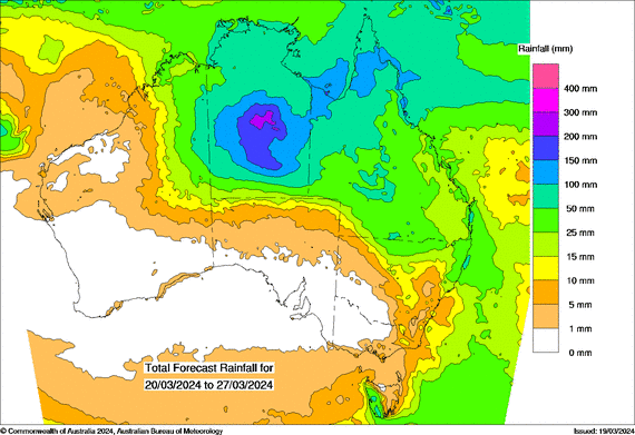
The average of the all weather models:
The average of all weather models, showing potential rainfall from Wednesday March 20th to Wednesday March 27th.
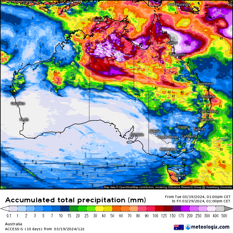
Each weather model:
Each individual weather model, showing potential rainfall from Wednesday March 20th to Friday March 29th
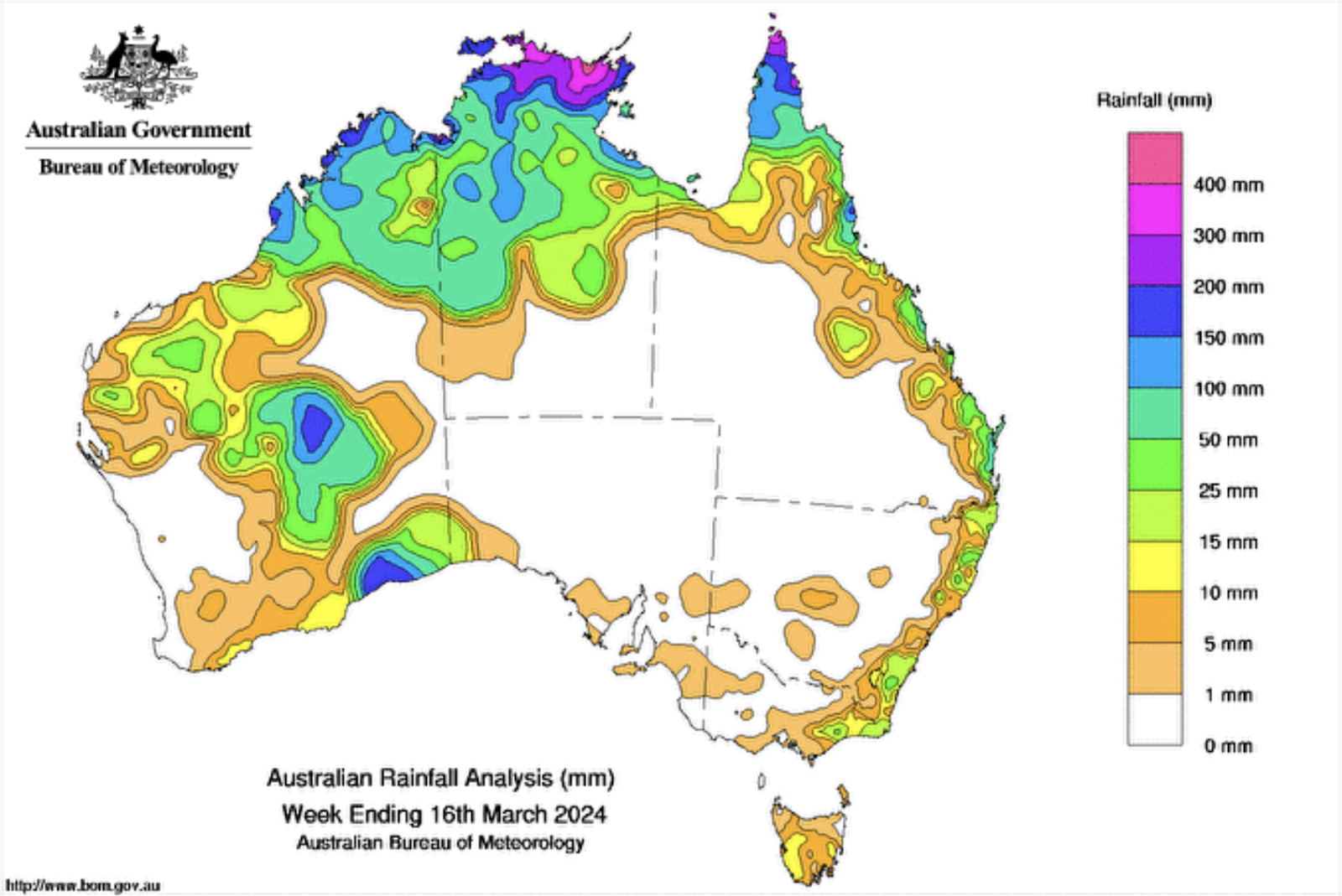
You may be curious to see what actually occurred last week, based on the different scenarios discussed in my last article.
Did the BoM get it right?
No.
To recap, every individual model was showing huge rainfalls in the west, and hardly anything over inland parts of the east.
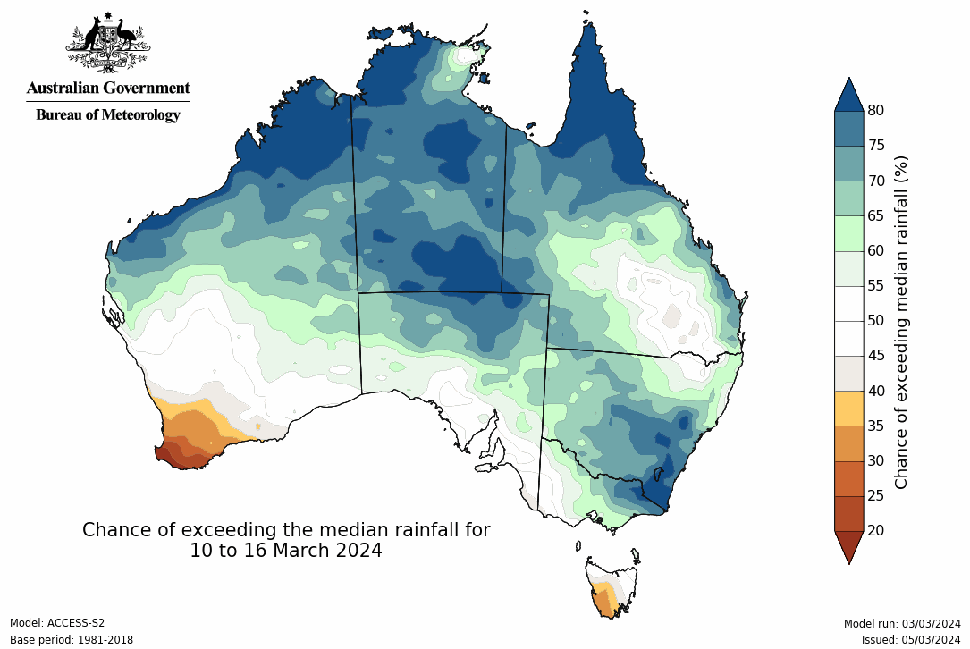
BoM’s "next week" seasonal forecast showed high chances of above average rain over the interior and through much of NSW. In reality, most of inland NSW received 0mm.
Their current "next week" forecast shows increased rain over Queensland, which is much more in line with the individual models.
Actual rainfall totals from 10th to 16th March 2024.
The BoM’s chance of exceeding median rainfall from Sunday 10th March to Saturday 16th March (issued 5th March).
The Pacific Ocean has begun its shift out of El Nino - I’ll have a full seasonal wrap up for you on Friday.

Another quiet week of weather is on the way. The coverage and strength of the frontal weather is expected to be more of a feature for those exposed...

The weather pattern is generally stable and with more high pressure on the horizon, this is indicative of the El Niño that is starting to influence...

A moderate cold front continues to slowly move through the southwest third of WA with moderate to heavy falls via thunderstorms along the coast and...