 Jane Bunn - Jane's Weather
We're likely at peak soil moisture across continent
The weather pattern is generally stable and with more high pressure on the horizon, this is indicative of the El Niño that is starting to influence...

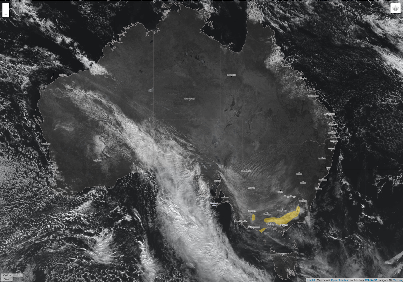
A juicy northwest cloudband is transporting moisture from the Indian Ocean down into southern Australia. This system ‘peaked’ in the southwest (with stand out totals of 25 to 50 mm) and is on its way across central parts heading for the east.
Winds have strengthened ahead of this, with damaging gusts in yellow areas in the southeast.
Satellite image and warning zones as at midday AEST on Wednesday 24th July
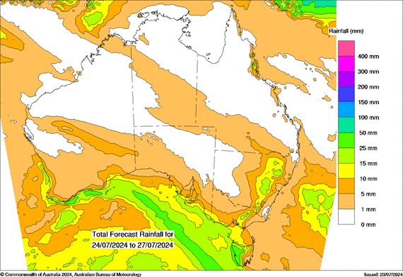
After a system ‘peaks’ it's a downward spiral from there…
Over the next few days it’ll cross the southeast - but if you’re inland or east of the ranges, it runs out of puff before it arrives. Parts that should pick up a nice drop are: the western slopes of the ranges in NSW, from the southwest up into the northeast in VIC, coastal parts of SA, and western TAS.
This is the first surge and there is another to follow on the weekend in the southeast.

With this one we have a band of light rain bringing out of season rain to the interior (NT, western QLD, parts of the far north), but the main talking point may be the chill. While there isn’t a huge amount of rain, it should be cold enough to fall as snow to low levels in SA/VIC/TAS and southern NSW (on Saturday and Sunday).
Rain potential from Wednesday 24th to Saturday 27th July
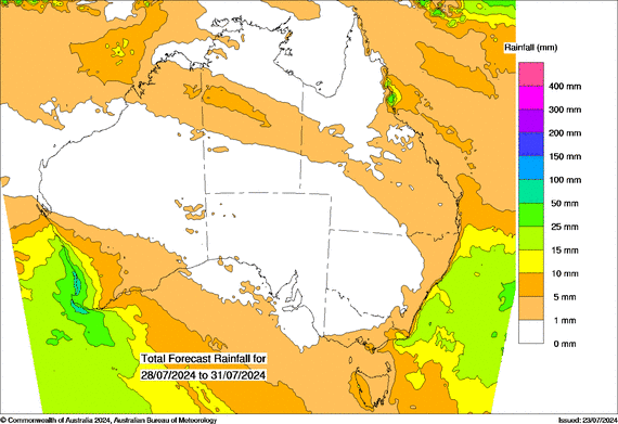
As we go into next week, high pressure settles in over southeastern Australia encouraging dry weather, while the next big system crosses the southwest, with another 25 to 50 mm as the stand out totals. The activity switches to the eastern coastal fringe in onshore winds, rather than inland parts.
Rain potential from Sunday 28th to Wednesday 31st July
Keep up to date with the latest on when and how much rain is likely at your place, by checking the full details at Jane’s Weather.

The weather pattern is generally stable and with more high pressure on the horizon, this is indicative of the El Niño that is starting to influence...

A moderate cold front continues to slowly move through the southwest third of WA with moderate to heavy falls via thunderstorms along the coast and...

A quiet weather pattern continues for much of the country this week with ridging in place over much of the continent and only the northern tip of...