 Jane Bunn - Jane's Weather
We're likely at peak soil moisture across continent
The weather pattern is generally stable and with more high pressure on the horizon, this is indicative of the El Niño that is starting to influence...

A sting in the tail of a series of cold fronts will make frost widespread over the southeast.
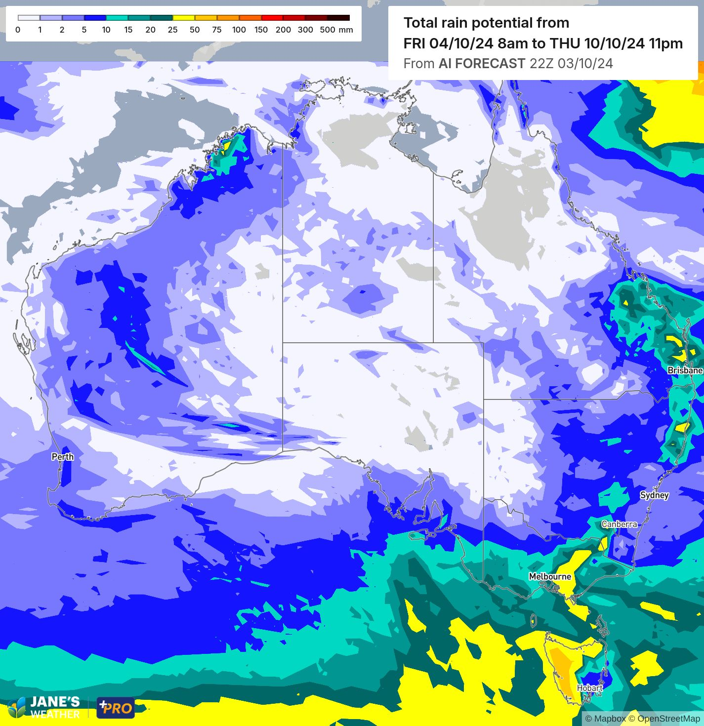
First we have hit and miss showers and severe thunderstorms, from western Queensland through to northern Tasmania on Friday, spreading through eastern Queensland and NSW on the weekend.
That’s just the first in a series of fronts, with more to cross the southeast over the weekend and early next week.
These following fronts lose the connection to tropical moisture so the rainfall quickly contracts to the southeast, with the rain dissipating as you go inland from the ranges.
It’s fairly quiet in the southwest, before the next rain system develops mid next week - the instigator for the next rain that should travel into the east later next week.
Potential rainfall over the next week (up to Thursday, October 10).
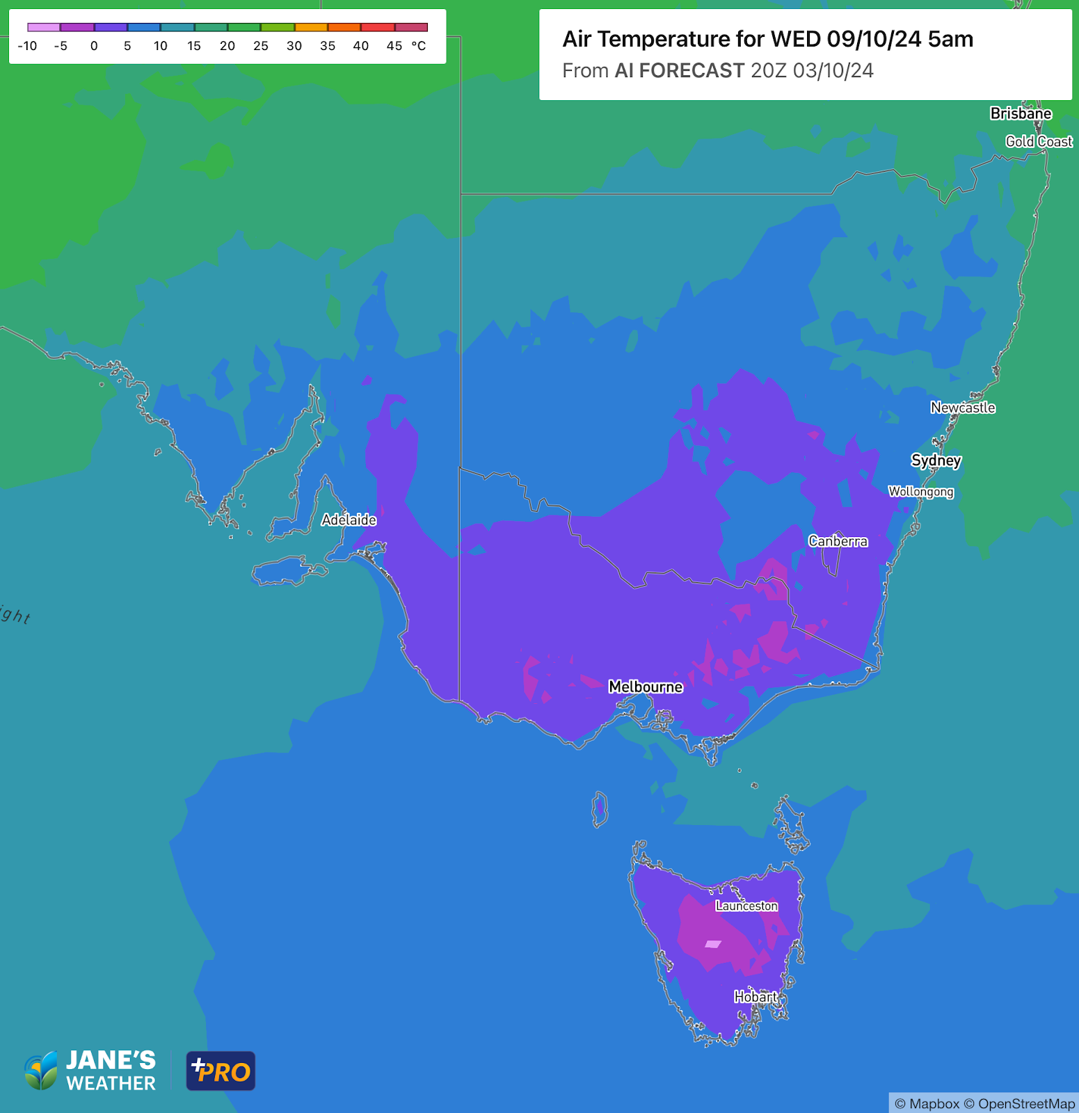
Let’s talk about the sting in the tail.
The last in this series of fronts has a burst of cold air, crossing the southeast on Monday into Tuesday. That cold air combined with clearing skies and lighter winds will lead to widespread frost in the southeast - particularly next Wednesday morning.
This map shows air temperature which is measured 1.5 to 2 metres above ground. On a still night the air forms layers that get colder as you head downwards, so 4C up at the weather station can be 0C on the ground.
Frost risk outlook for Wednesday, October 9.
This colder air also works its way up the east coast, dropping temperatures and creating showery conditions - the middle of next week may feel a touch wintry in eastern NSW and southeast Queensland.
Check the full details at Jane’s Weather to keep up to date on what the models are projecting for your spot.


The weather pattern is generally stable and with more high pressure on the horizon, this is indicative of the El Niño that is starting to influence...

A moderate cold front continues to slowly move through the southwest third of WA with moderate to heavy falls via thunderstorms along the coast and...

A quiet weather pattern continues for much of the country this week with ridging in place over much of the continent and only the northern tip of...