 Jane Bunn - Jane's Weather
Spring preview for some as weather changes
A moderate cold front continues to slowly move through the southwest third of WA with moderate to heavy falls via thunderstorms along the coast and...

We’re heading into a stormy weekend through much of the eastern states - as warm to hot conditions linger and humidity spreads into the southeast.
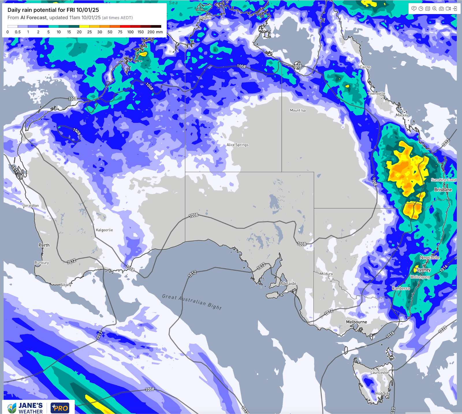
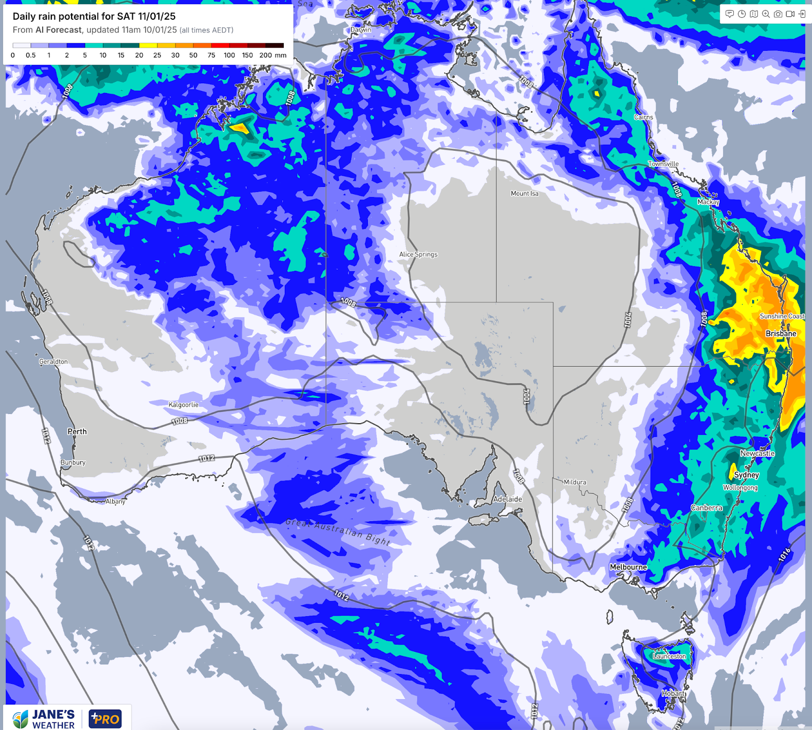
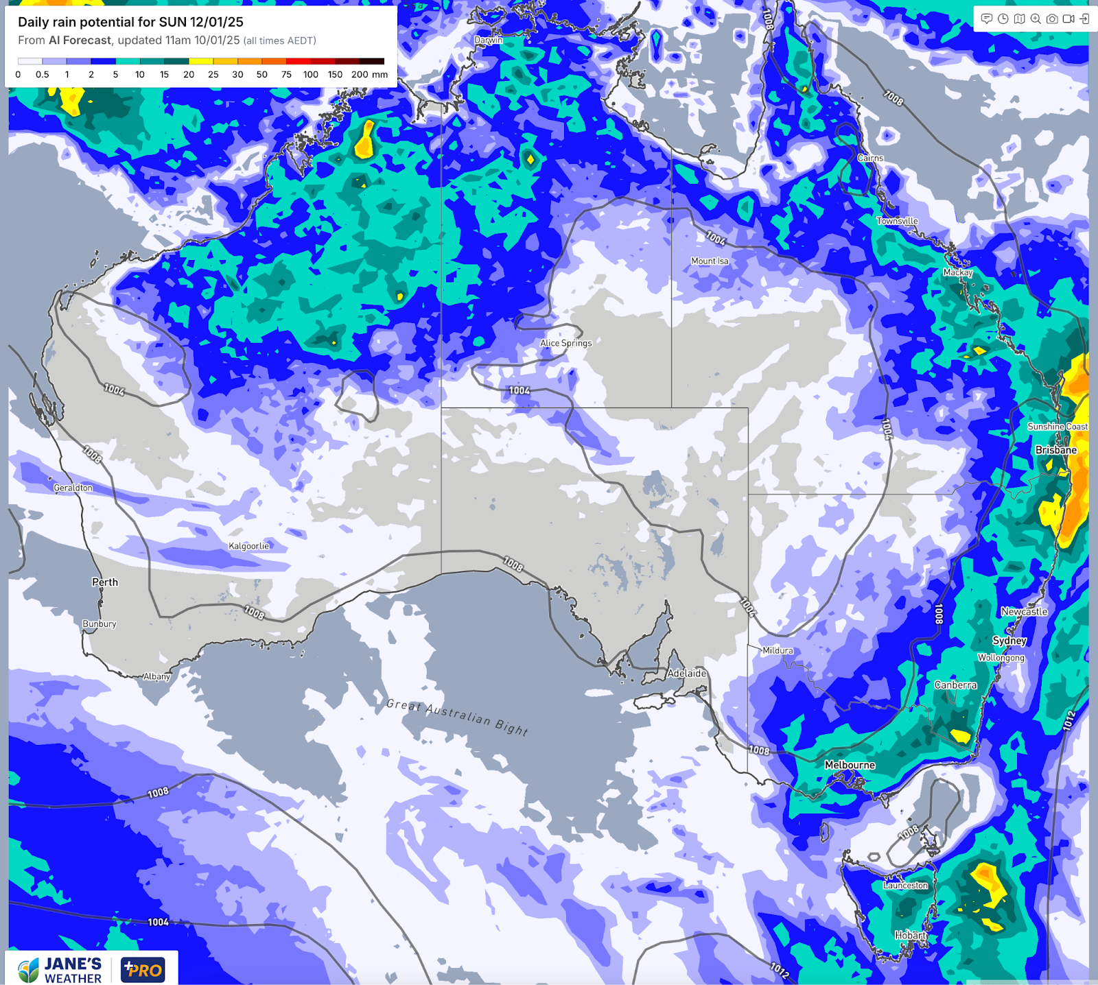
Eastern parts of Queensland, NSW and Victoria are in the firing line for hit and miss showers and thunderstorms, with the activity increasing as the weekend progresses. It spreads to Tasmania from Saturday, and western parts of Victoria and southwest NSW on Sunday - but the weather pattern doesn’t let it reach South Australia.
The current weather pattern is the perfect recipe for this hit and miss activity.
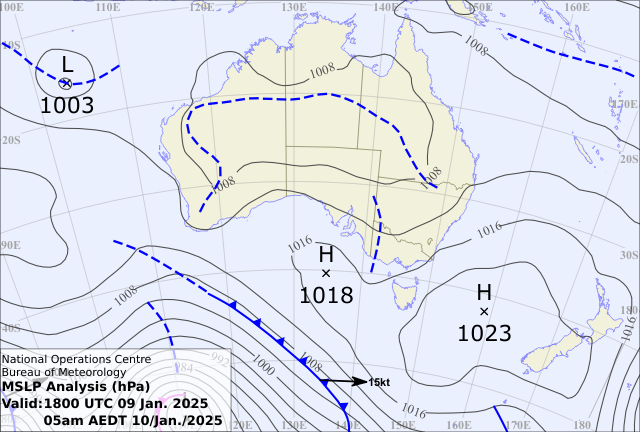
High pressure is centred over the Tasman Sea between Australia and New Zealand. This spot pushes warm and humid air from the oceans to our east into the eastern states. This juicy air runs into trough lines which bring instability, making the air rise into cumulus then cumulonimbus if they can grow high enough. When we reach that cumulonimbus stage we get a thunderstorm.
The troughs also act like a stop sign, not letting this moisture laden air travel any further westwards. The trough doesn’t move far enough to let this activity into South Australia, stopping it near the border as you can see in the day by day maps below.
The weather pattern on Friday morning
Potential rain on Friday 10th January
Potential rain on Saturday 11th January
Potential rain on Sunday 12th January
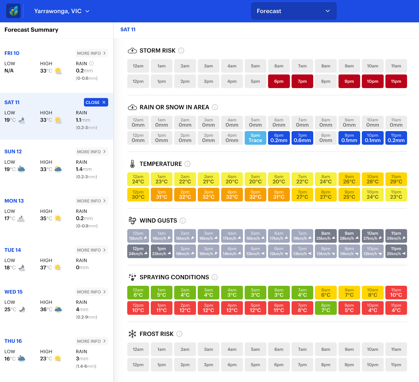
Check the full details at Jane’s Weather to keep up to date on what the models are projecting for your spot. We break it down into an hour by hour storm risk to let you know when your spot is in the danger zone, and also when you are guaranteed a dry break.
Threat toolbox for Yarrawonga, VIC on Saturday 11th January

Jane’s Weather provides hyper local weather forecasting based on the consensus of all the weather models, using Machine Learning and AI to calibrate the forecast to conditions at your farm.
We include updates on temperature, rain and wind, along with evapotranspiration for efficient water usage, frost risk, growing degree days and a detailed spraying forecast customised for any property in Australia.

A moderate cold front continues to slowly move through the southwest third of WA with moderate to heavy falls via thunderstorms along the coast and...

A quiet weather pattern continues for much of the country this week with ridging in place over much of the continent and only the northern tip of...

It is a quiet weather week across the country, with a new large high moving into place, this leading to settled conditions this weekend and next...