A tropical low near the Gulf of Carpentaria has been there for a while… but now it’s starting to move southwards, pushing rain across much of Queensland.
It’s shaping up to be a big area of rain stretching from the northwest into the southeast.
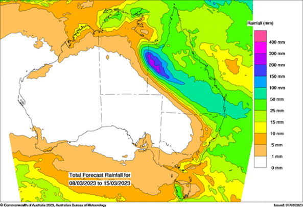
The heaviest falls are likely to be over northwest Queensland, with a high risk of accumulations (since it began raining) of more than 400mm.
Even the southeast may see 50 to 100 mm in total.

Above: rain projections for the next 8 days.
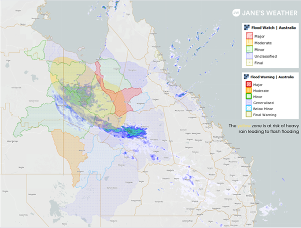
This is a serious situation - there are warnings for heavy rain leading to flash flooding, and river flooding:

Above: radars and warning areas on Wednesday morning.
The rain is heavy in the northwest until the end of the week, then the deluge ends with lighter falls from Saturday.
The rain increases in southeast QLD later in the week, with most of it falling between Friday afternoon and Monday morning. See our hour by hour guidance with full details on the timing and amount of rain for any spot in Australia.
Next week looks fairly quiet, possibly lingering into the following week. The Madden Julian Oscillation (a pulse of tropical energy that encourages these weather systems) moves into a region that suppresses rainfall in northern Australia. It may return to encourage further tropical rainfall systems later in March.
Sign up for alerts at Jane’s Weather below to stay ahead of what is on its way.
Our notifications include the weather summary, rain, winds and comfort, evapotranspiration, frost risk, growing degree days and weather conducive to pests and diseases, tailored to any property in Australia.
 Results

