Another week and another big rain system.
We know these will keep coming as we continue through spring and summer, because the Pacific Ocean is in a La Nina phase and sends excessive tropical moisture towards Australia, while the Southern Annular Mode (a driver of our pressure) is likely to remain favourable for low pressure development in the weeks and months ahead.
These two work together to bring more lows than usual, with heavier than average rain for those in their path.
The current low is located over South Australia on Wednesday. Note how it is cradled by high pressure that forms the shape of a jelly bean - that means the low is slow-moving which leads to even more rain.
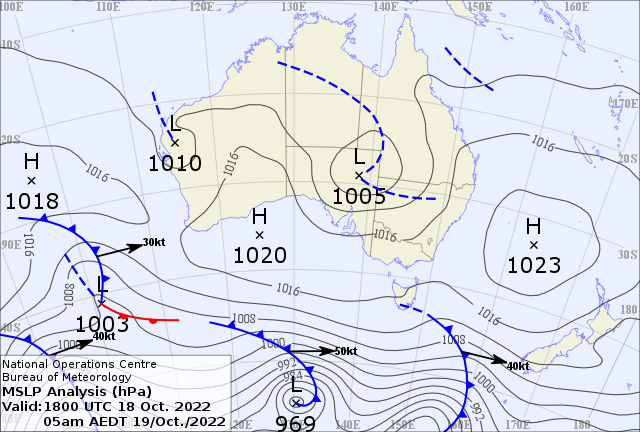 Weather map as of 5am on Wednesday 19th October
Here is how it could play out each day:
WEDNESDAY
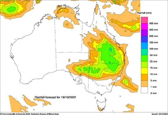
Areas of rain over QLD, NSW and parts of SA, with hit and miss thunderstorms bringing localised heavy falls. Dry for most of VIC and TAS.
You can clearly see where the rain falls with respect to where the low is situated, and how high pressure blocks the rain.
THURSDAY
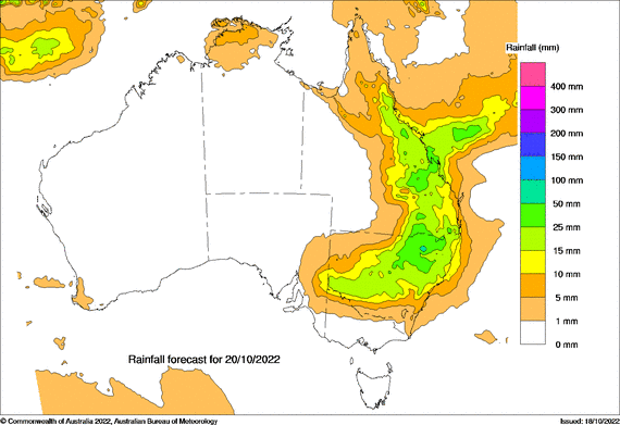
The low moves eastwards… slowly, so the rain slightly contracts southeastwards. Focused more on eastern QLD, still much of NSW, and only grazing northern VIC.
FRIDAY
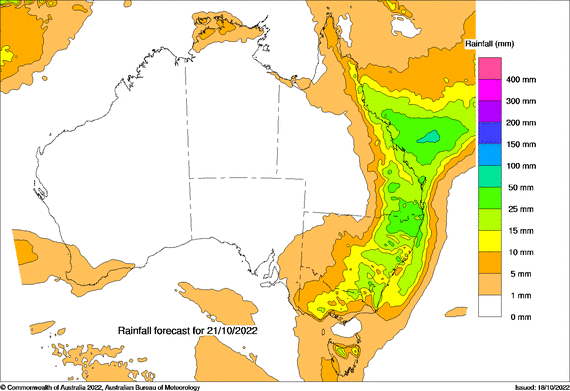
Friday should bring a band of wet weather right down the east coast and adjacent inland, and over much of VIC, extending into northern TAS. The band is likely to be comprised of hit and miss thunderstorms. These bring heavy rain to those directly underneath, but by nature they hit one property and miss the next.
SATURDAY
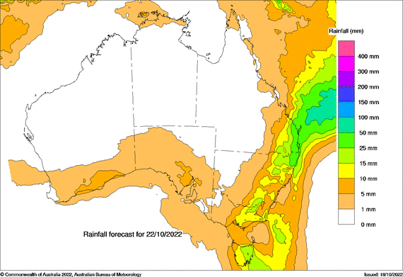
This band continues to contract eastwards on Saturday. Areas of rain with hit and miss heavy thunderstorms.
Then we have yet another low brewing, set to move through the eastern states, from Sunday into early next week. Head to Jane’s Weather to see the details on what the weather models are projecting for any spot in Australia.
Sign up for alerts at Jane’s Weather below to stay ahead of what rain is on its way.
Our alerts cover the overall weather forecast, plus: rain and snow, frost risk, good spraying conditions, hot and cold temperatures, heat stress and wind chill, and more, tailored to any property in Australia.
 Results

