Another week and yet another example of how La Nina and a negative Indian Ocean Dipole (IOD) are working together to influence Australia’s weather in a big way.
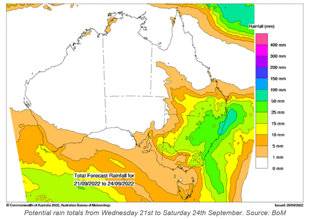
This particular example is a low crossing NSW on Wednesday and Thursday.
It began in the west over the weekend, affected South Australia on its way past on Tuesday, and should take two days to cross NSW. Then a trough forms off the east coast on Thursday, finally moving away on Sunday.
This has brought significant rain to northwestern VIC, and is doing so for much of NSW and southern Queensland. Looking further south though, where TAS and much of VIC miss out, protected by a ridge of high pressure. The rain only falls for those in the path of the low.

La Nina and a negative IOD both act to push excess moisture towards Australia from the Pacific and Indian Oceans.
This current La Nina has just begun and is set to continue making that push until early in the new year, while the negative IOD has been in full swing since autumn, set to decay in early summer. Do keep in mind that it can take a few months to ‘come down’ from this state of excess.
So, if you are wondering whether these rain systems are going to keep coming in the weeks and months ahead, the answer is yes.
There is one caveat to that, as it all depends on where the lows and troughs move as to who is in their path and gets the rain.
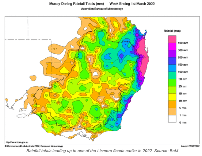
The most significant rain is when a slow moving low sets up just off the east coast. Those living in areas just to the south of the low can experience incredibly heavy rain (not the 25 to 100 mm peak falls from this system, but huge totals like we saw in the big events earlier this year). If that low tracks down the coast, then the heavy rainfalls move with it.
 These are the things to watch out for on the weather maps in the spring and summer ahead - but unfortunately, no one can tell you where the lows are likely to move, more than a few days leading up to the event.
In the meantime, wet catchments and full dams mean that every time these lows move past, flooding increases. There are numerous flood warnings in place from QLD through to VIC now.
A weak front passes across TAS and VIC on Friday into Saturday - dropping temperatures for Grand Final Day in Melbourne. Showers should clear before the afternoon, with sunshine and a cool wind for the game.
The NRL Grand Final isn’t quite on the models yet - they only go out 10 days - but you can track the details as it approaches at Jane’s Weather.
Sign up for alerts at Jane’s Weather to stay ahead of what rain is on its way.
Our alerts cover the overall weather forecast, plus: rain and snow, frost risk, good spraying conditions, hot and cold temperatures, heat stress and wind chill, and more, tailored to any property in Australia.
 Results

